
Four Easy Big Sur Hikes You Can Do In One Day!
Pfeiffer Falls, Partington Cove, McWay Falls & Soberanes Point to Whale Peak


📍The Big Sur Coastline is one of the most spectacular places in the world. It’s full of little treasures, a rich history and some of the most scenic places in California. I’ve already featured one of these places, “The Crown Jewel of the California State Park System”, Point Lobos Natural State Reserve. If you want to read the “Dirt” on that trail click the link.
There are a few more state parks along Highway 1 south of Point Lobos. This post will feature four more trails in three California State Parks and the beauty of these hikes is they are short, easy and you can hike all four trails in one day…and still have time for breakfast and dinner! Take a day and head down the California coast for an epic roadtrip.
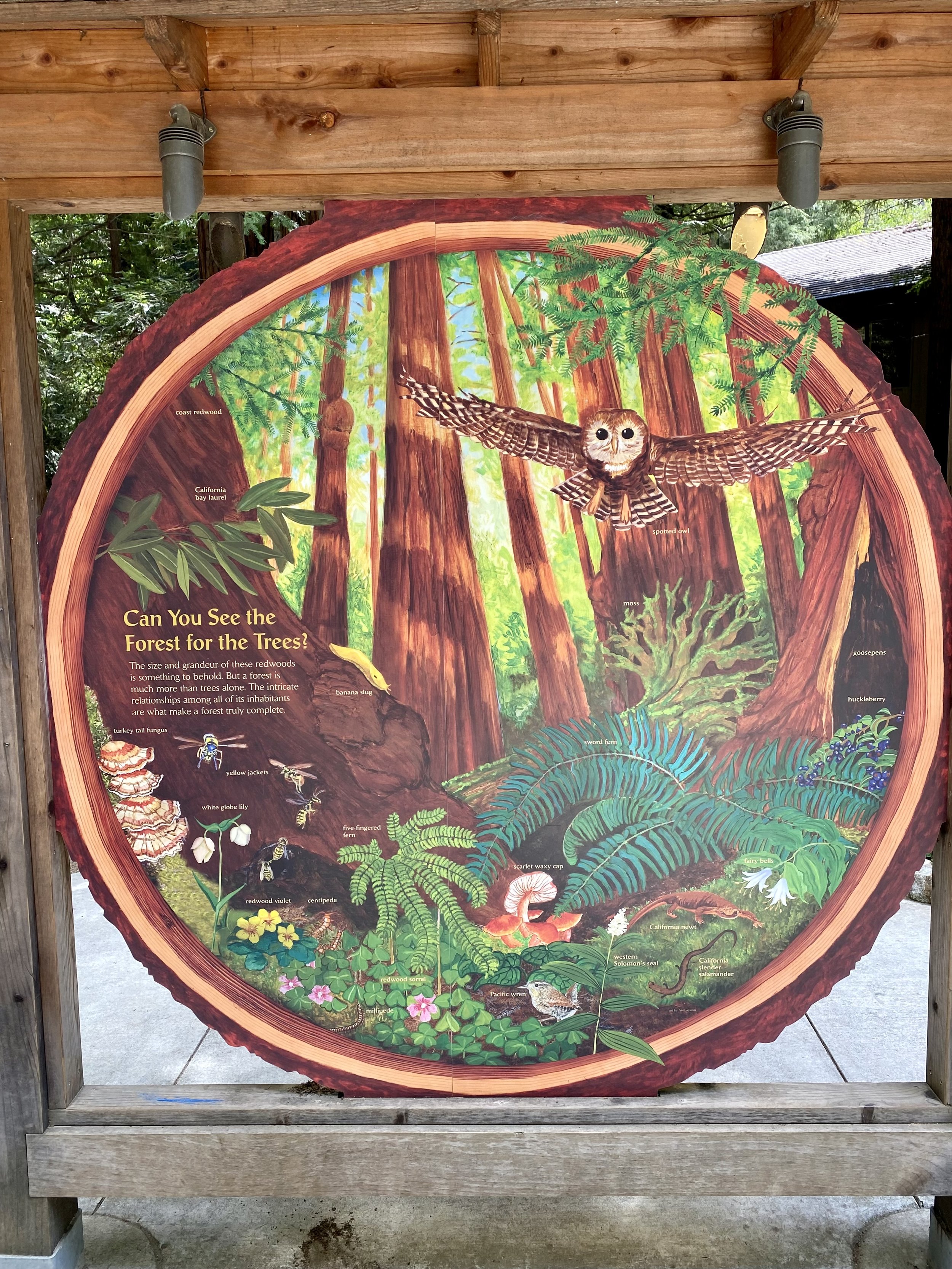
⛰ All of these hikes take place along Highway 1, south of Carmel. Resting on the western slopes of the Santa Lucia Range, the mountain peaks tower above the coast where forests of giant Coastal Redwoods meet the Pacific Ocean. Home to a diverse ecology, you might see squirrels, bobcats, racoons and foxes on the ground and hawks, owls, maybe an eagle or if you’re luck the endangered California Condor in the sky. This area has a rich history dating back nearly 8,000 years to the native Esselen and Rumsien people, with some descendants still living in the area. The early 1800’s brought settlers who claimed the land and began ranching and farming. Some of those settlers names - Pfeiffer, Partington and Post can still be found on street signs, businesses and landmarks today.
These are all short and easy hikes. The toughest is Pfeiffer Falls Trail via Valley View Trail, two trails in one (🙌🏼), which is about 3.5 miles, out and back trail with about 550’ of elevation gain. The shortest is McWay Falls, a short 1 mile hike and less than 100’ of elevation. Regardless the difficulty of the trails, the views are worth it! And, you don’t have to get up too early and you’ll be back for dinner! I love taking a day to explore 3 state parks, 4 amazing trails, and have plenty of sunshine left to catch a sunset! Enjoy!
🥾 First stop will be Pfeiffer Falls, in Pfeiffer Big Sur State Park. It’s about 26.5 miles south of The Crossroads Carmel on Highway 1. It’s actually the exact course of the Big Sur International Marathon held annually on the last weekend in April…so don’t plan this trip then 😳.
I started my day planning to get to Pfeiffer Big Sur by 10AM. It’ll take about an hour to drive the scenic coastline from The Crossroads Carmel. You’ll pass the Carmel Highlands, Garrapata State Park, Bixby Bridge, Point Sur, Molera State Park and Big Sur to get to the State Park. Here’s a Google Pin to Pfeiifer Big Sur.

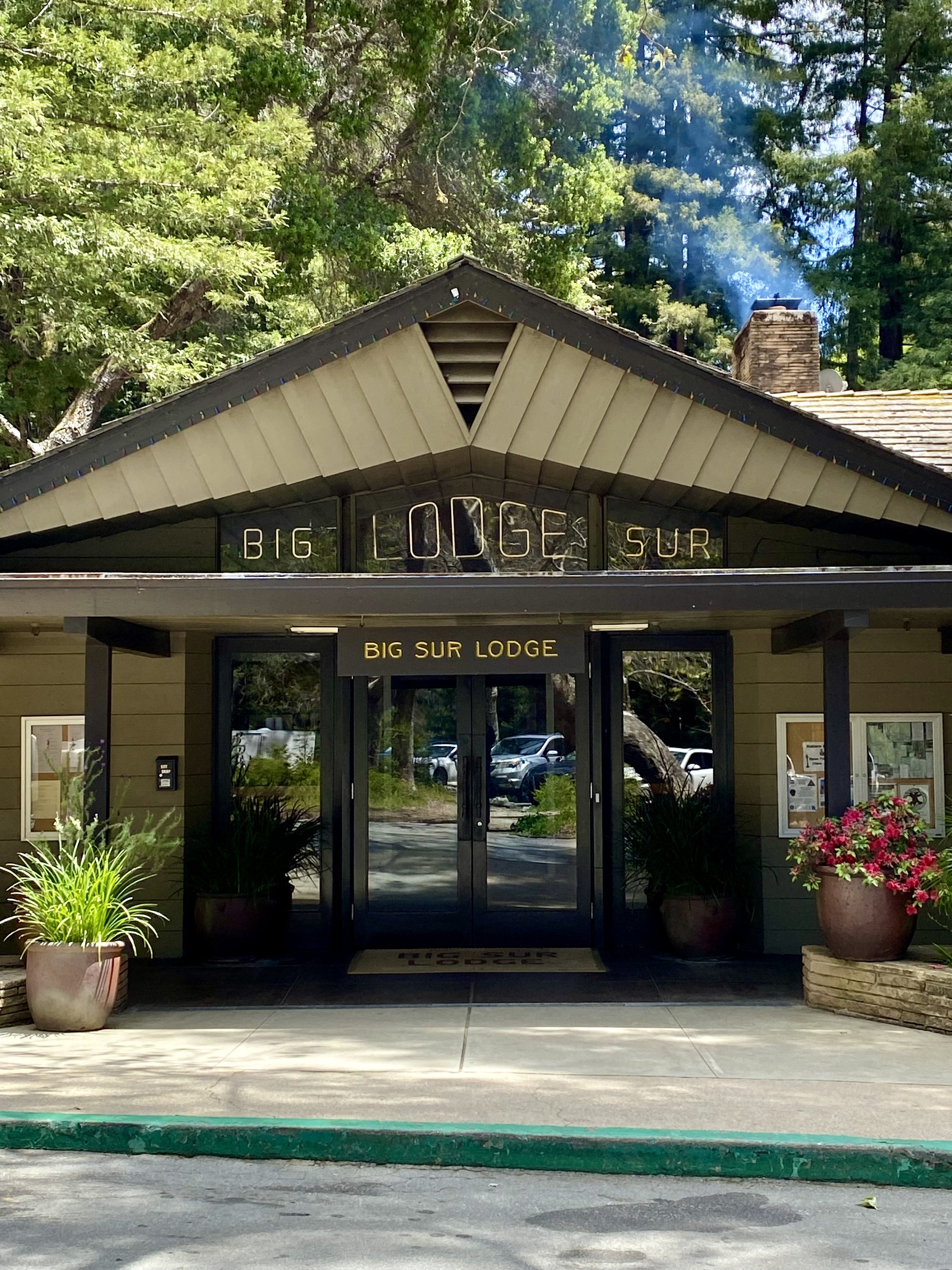
Pfeiffer Big Sur State Park is a popular destination for campers, hikers and many visitors. The park is open from 8AM to sunset. It has a general store, restaurant, hotel, restrooms and parking. A $10 per vehicle entry fee is charged at the kiosk. Your paid entry is good for the remainder of the day at all California State Parks so hold onto your receipt. You may need it later. You can also park outside the park and enter on foot for free.
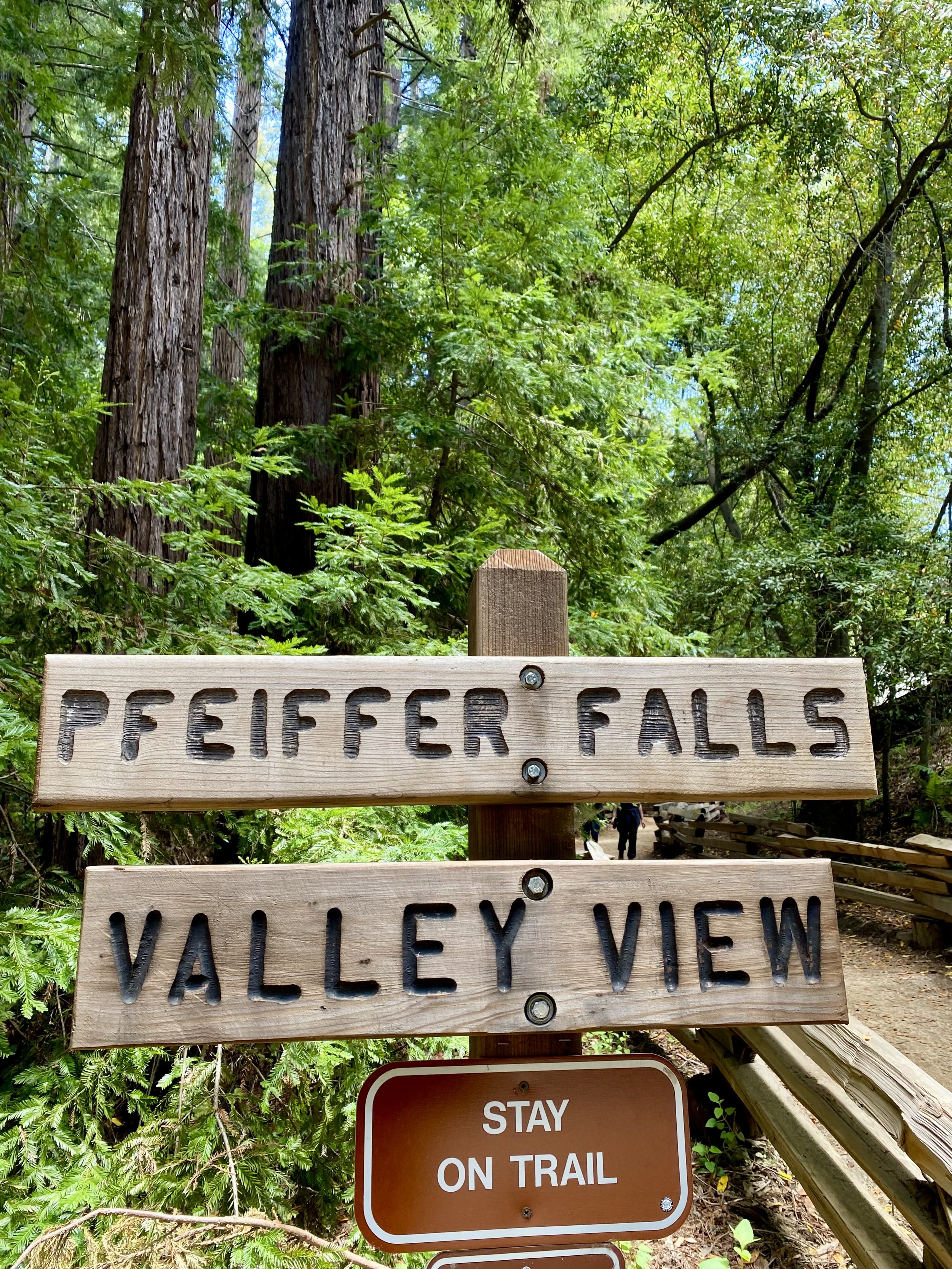
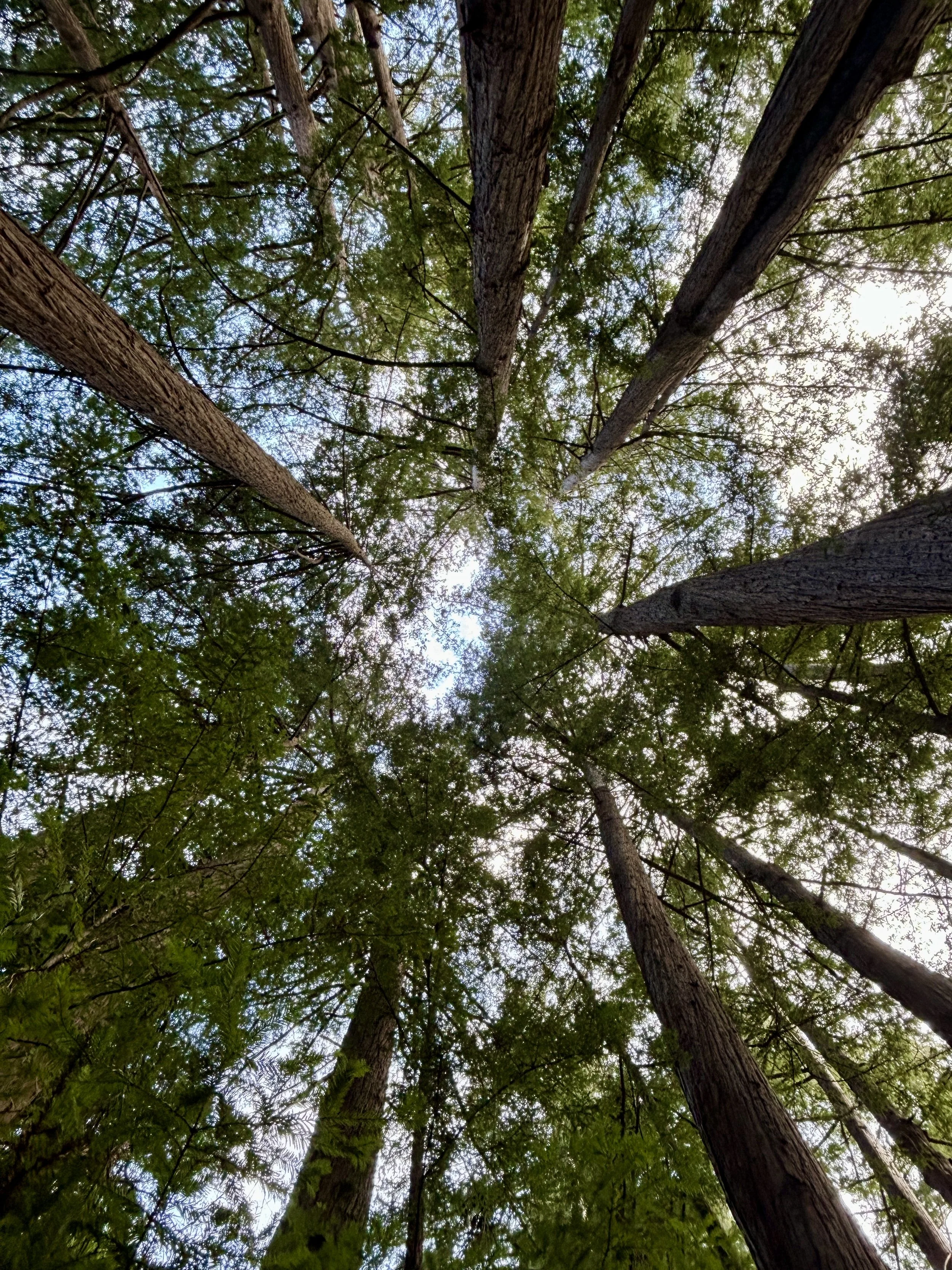
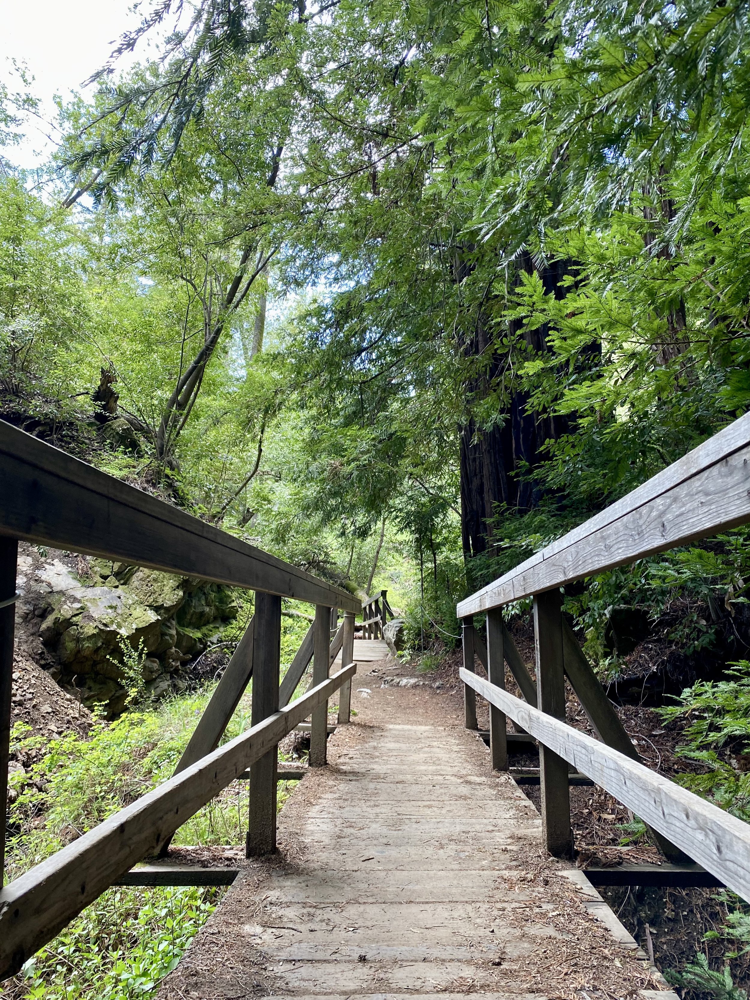
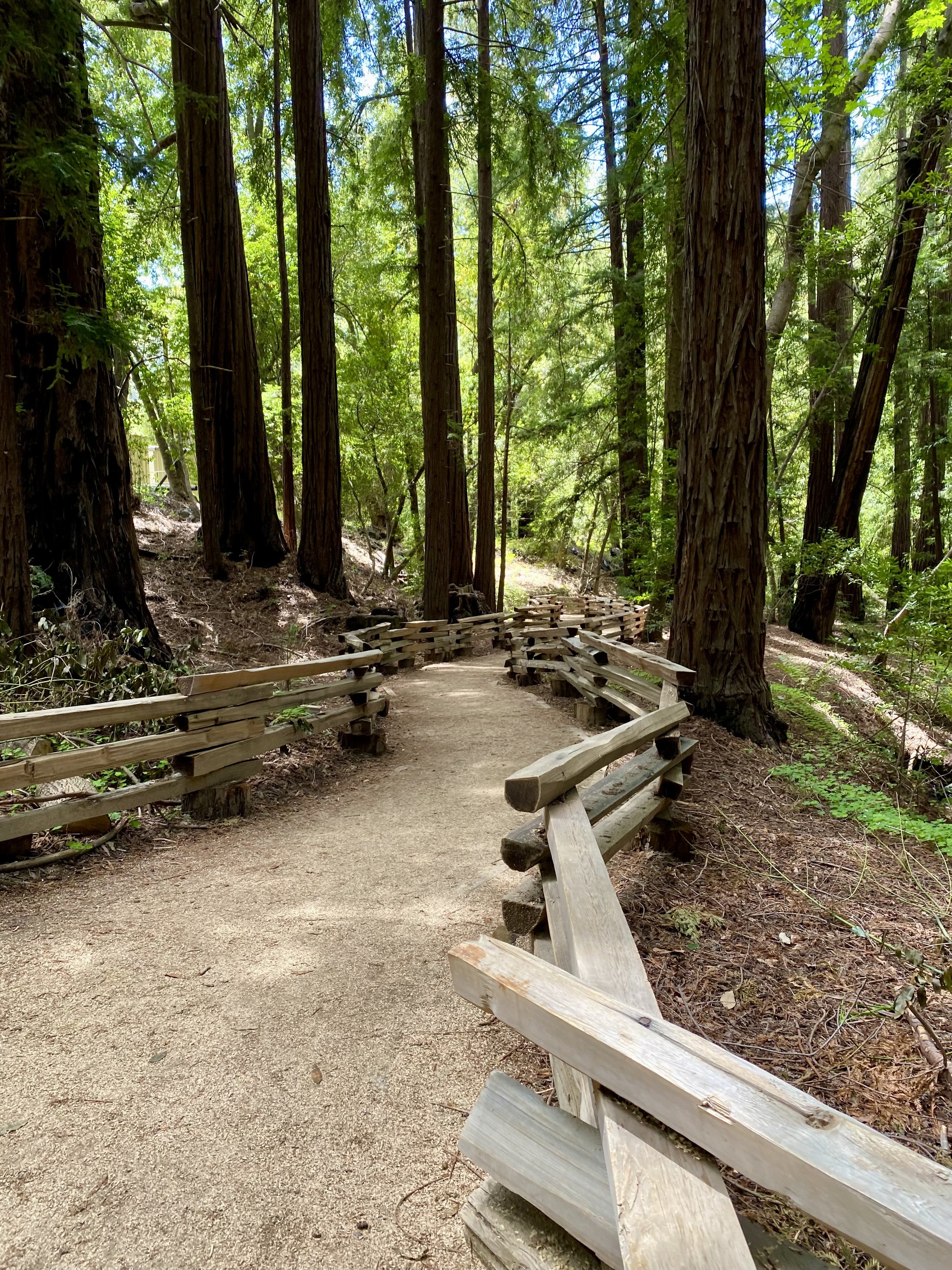
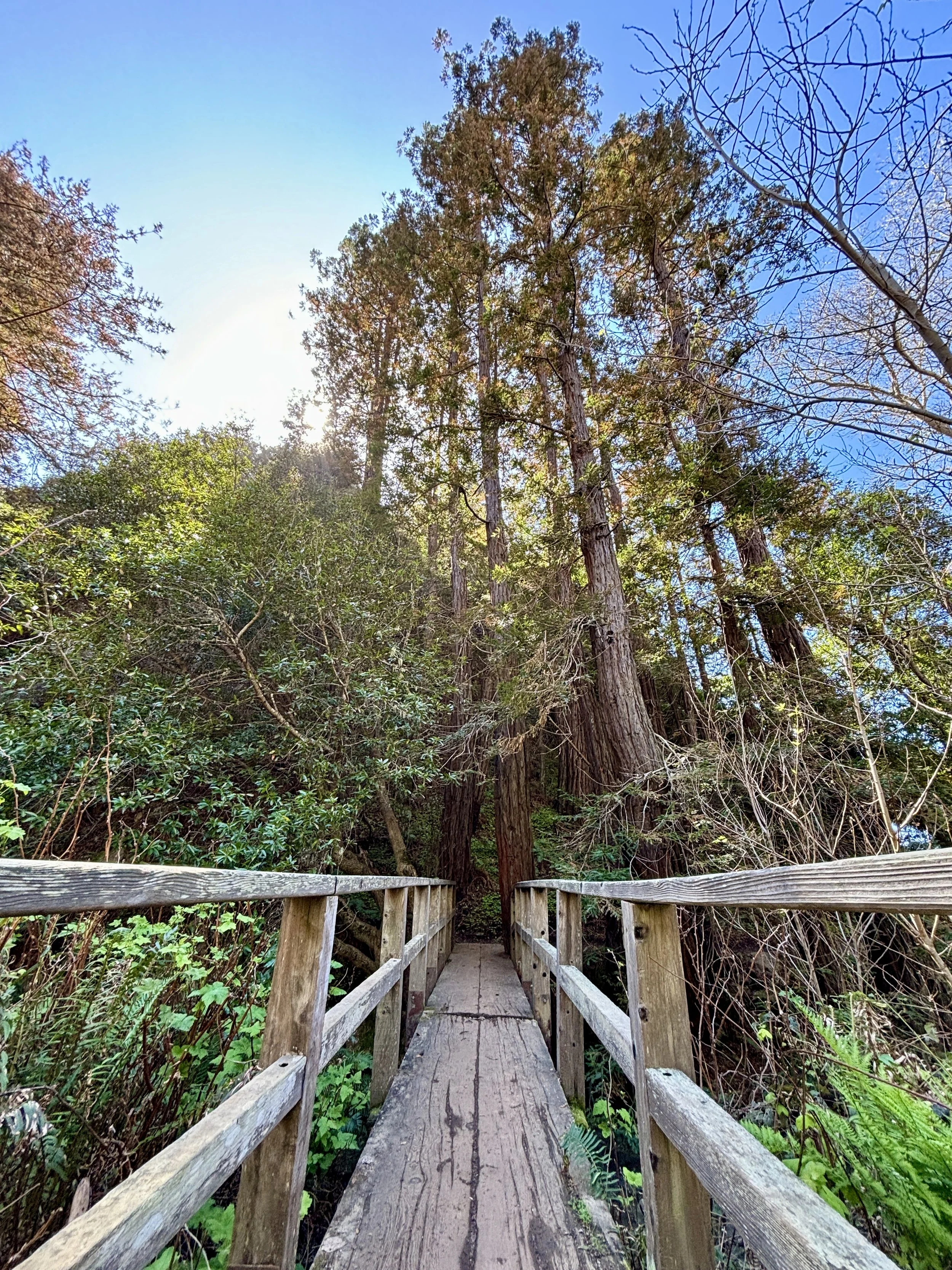
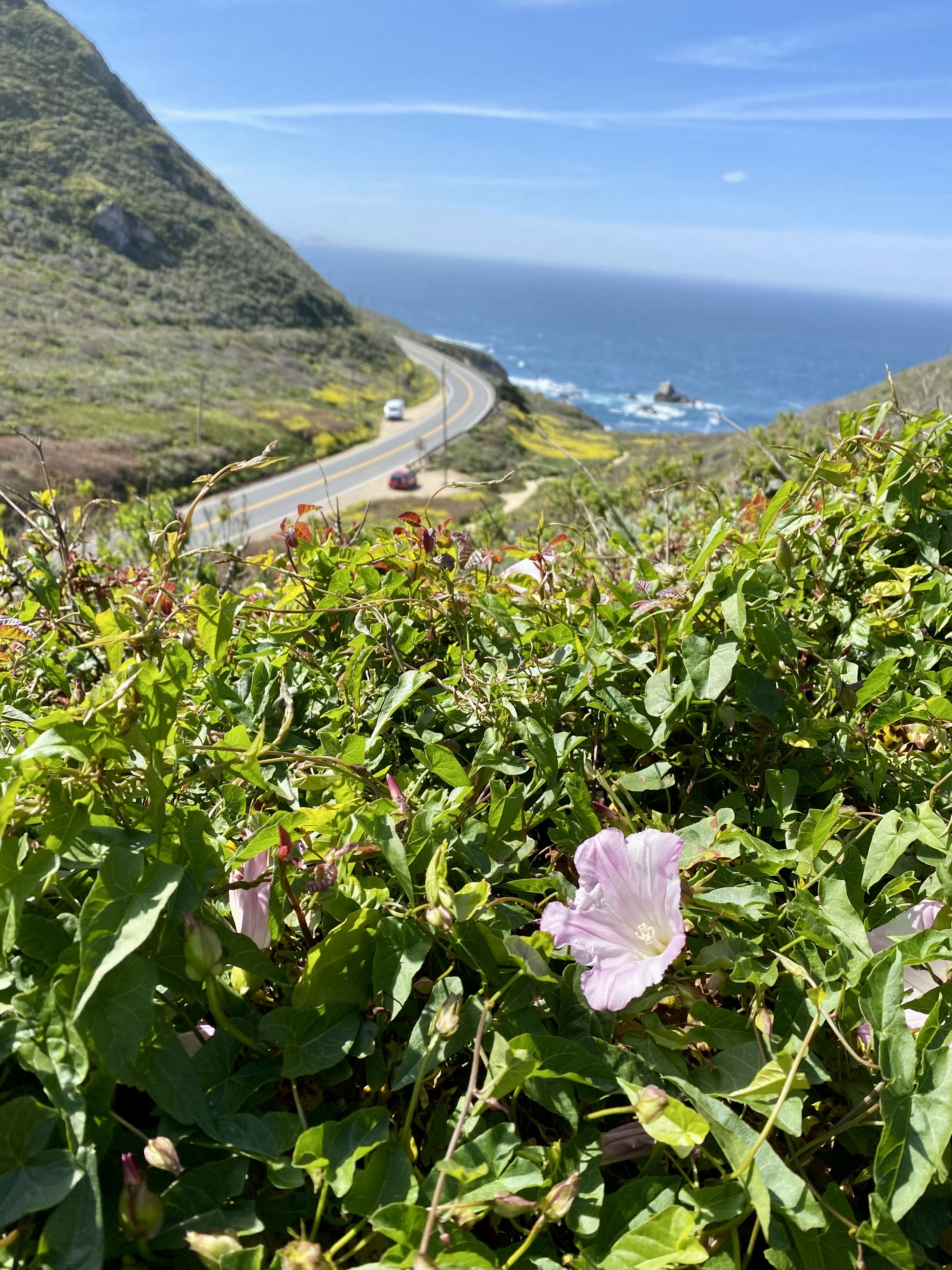
The Pfeiffer Falls Trail starts near the Big Sur Lodge and is well marked. Follow the signs to Pfeiffer Falls/Valley View Trail, a well travelled trail through the coastal redwoods along the Pfeiffer-Redwood Creek. The trail winds up the path to a detour. Currently, the direct trail to Pfeiffer Falls is closed, however, the detour on Valley View Trail will get you to the Falls. Follow the detour across the wooden bridges and up the hill.
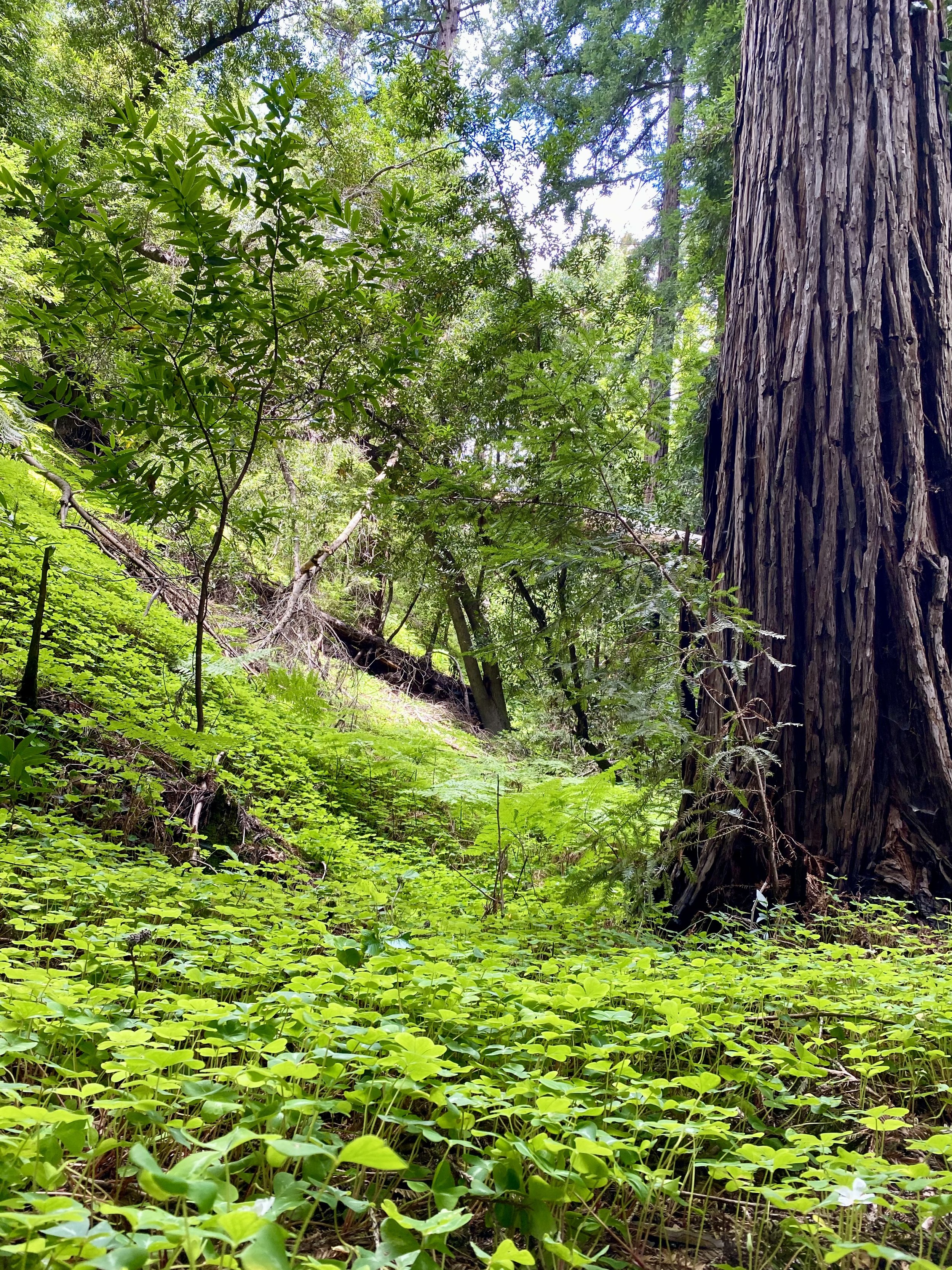
You’ll notice the vegetation begin to change as you rise out of the redwood canopy, where you’ll notice more oak trees and brush. the temperature will likely increase as the sun hits this part of the trail more but there’s usually a breeze blowing through the Big Sur valley to cool you down.
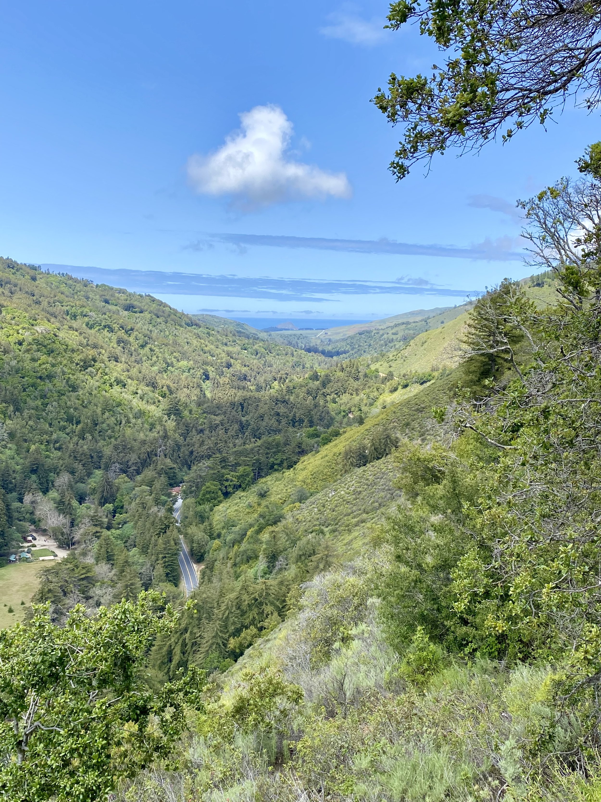
About .6 miles up the trail you’ll notice a “Y”. The trail to the right will take you to Pfeiffer Falls, the trail to the left will take you to the Valley View. I recommend the Valley View Trail. The trail will continue up a single track trail about.3 miles to the Vally View scenic viewpoint. You’ll come to the end of the trail, a bench and a view stretching to the coast with Point Sur in the distance. This is a good spot for a breather, grab some water and head back down to the falls.
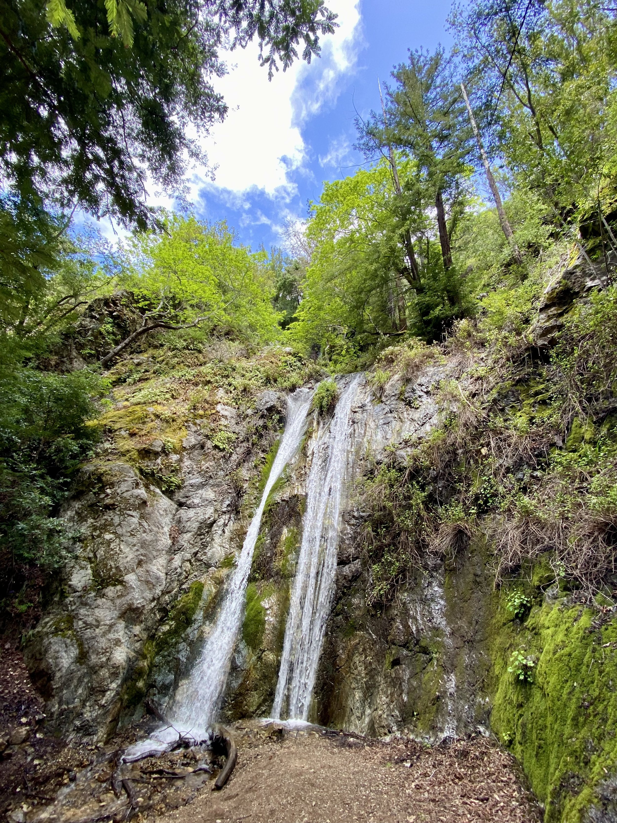
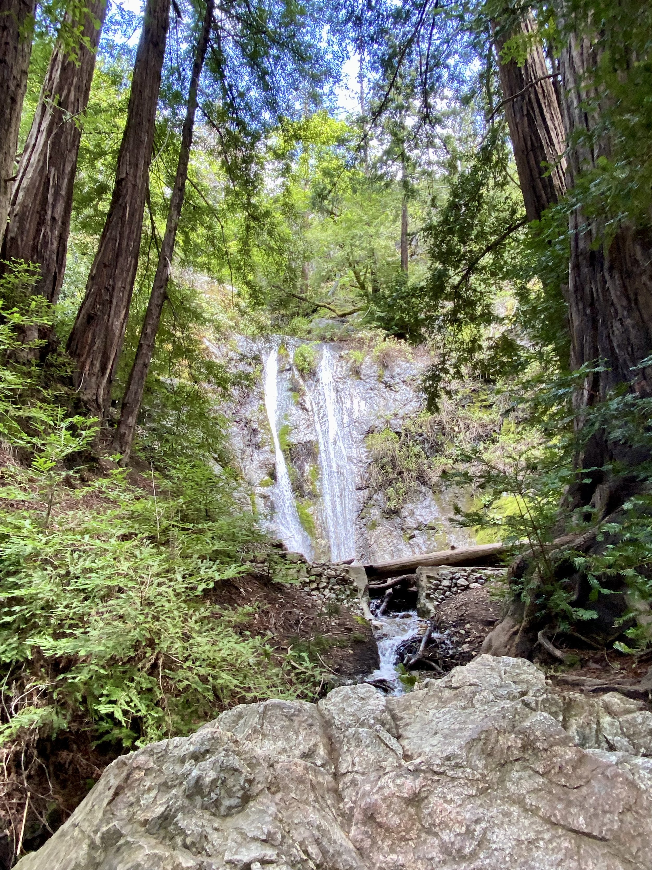
Continue down Valley View trail, back to the “Y” and follow the sign to Pfeiffer Falls. You’ll descend the trail back into the redwood canopy, cross a few bridges and be ushers up the stairs to the Pfeiffer Falls. Awaiting you is the 60’ Pfeiffer Falls viewing area. A quiet location next to Pfieffer Falls with seating to sit and listen, rest and take a few photos before heading back the way you came. Don’t miss the viewpoint at the foot of the steps, along side the creek and atop the large rock, a great viewpoint of the falls.
Follow the trail back to your starting point. This trail should take about 1.5 to 2 hours, depending on your pace. Next stop, head south on Highway 1, about 10 miles, to the Partington Cove Trailhead.
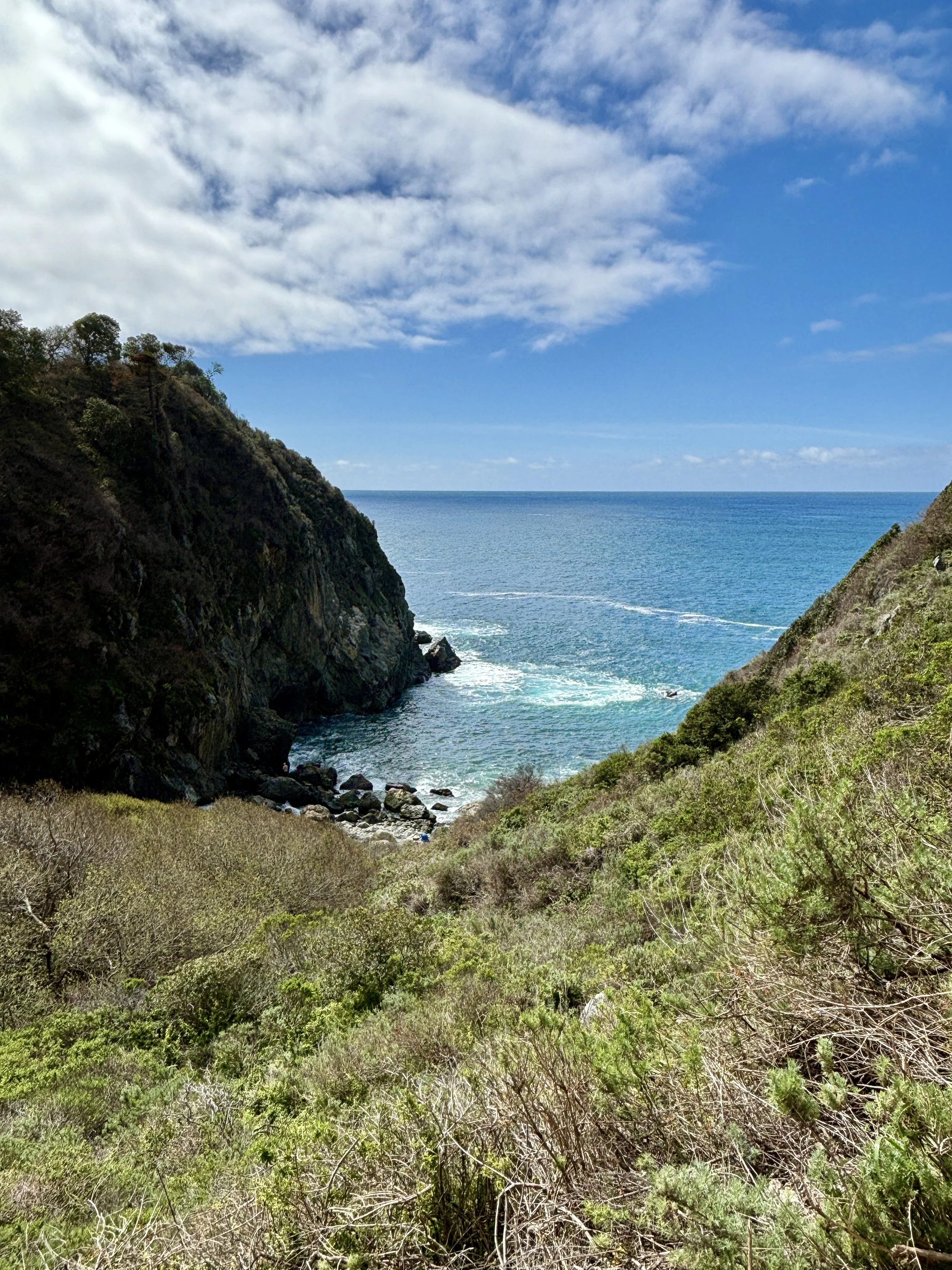
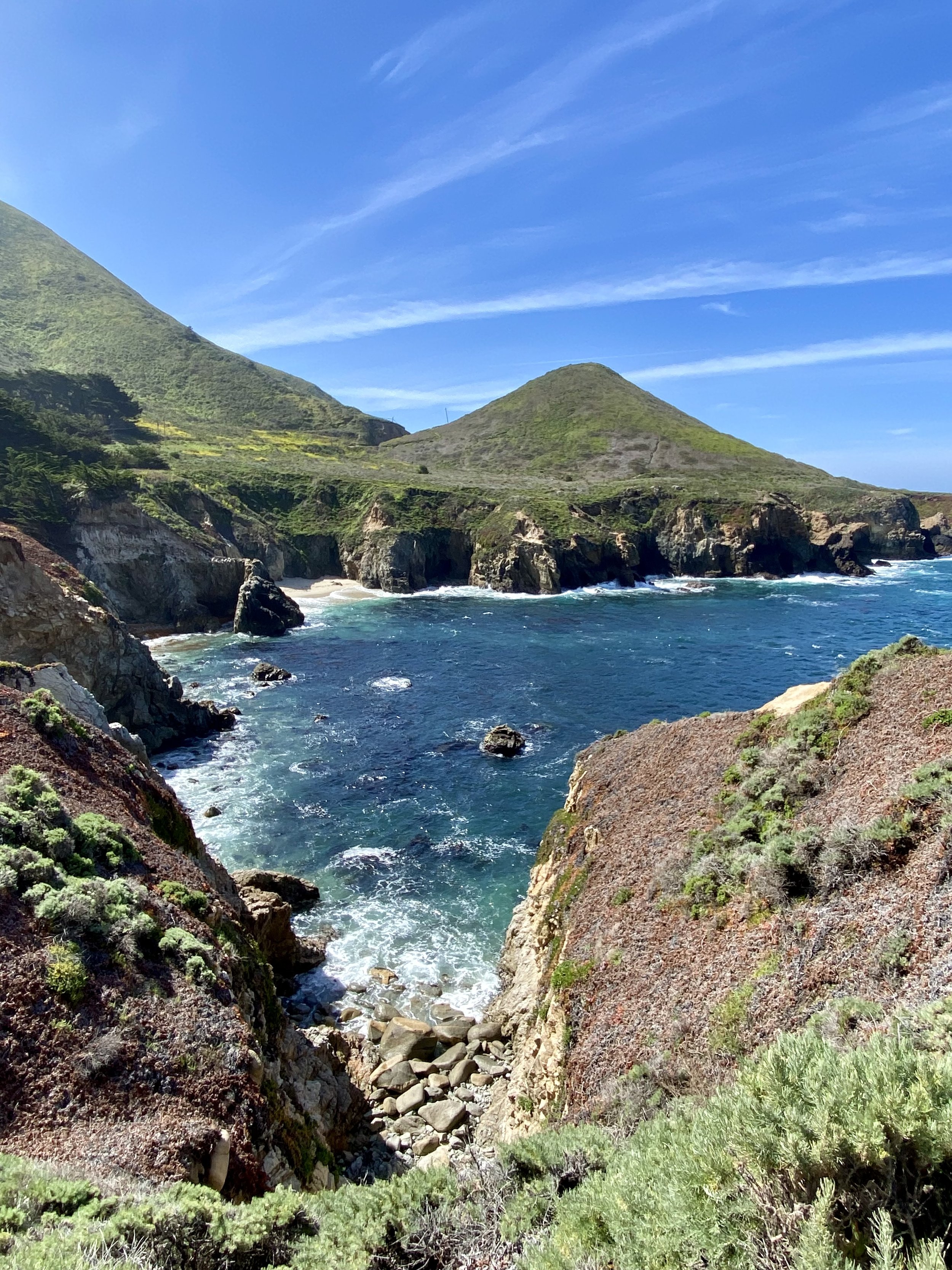
Partington Cove - Julia Pfeiffer Burns State Park, the second hike of the day, is a little over a mile, out and back well travelled dirt road and single track trail with nearly 200’ of elevation. The hardest part of this hike is finding a place to park. Located within the Julia Pfeiffer Burns State Park, this trail is not supported. There is no parking lot, restrooms, water or trash bins. Parking is along Highway 1 in the dirt turnouts near the trailhead and is often pretty busy, especially on weekends. Please BE CAREFUL when parking and walking along side the highway to the trailhead. Here’s a Google Pin to Partington Cove.


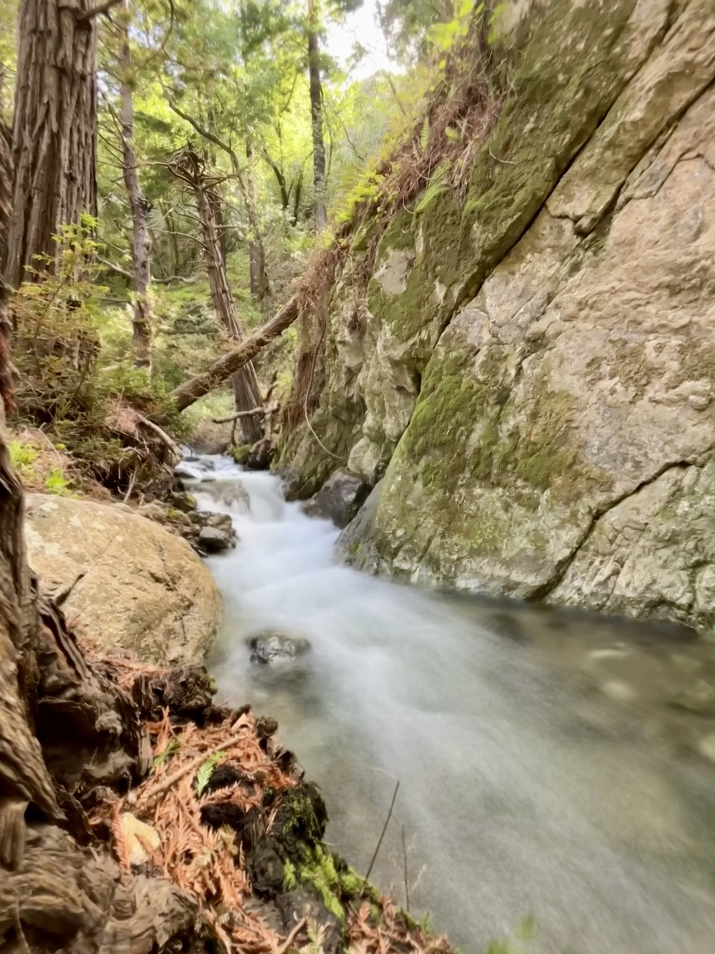
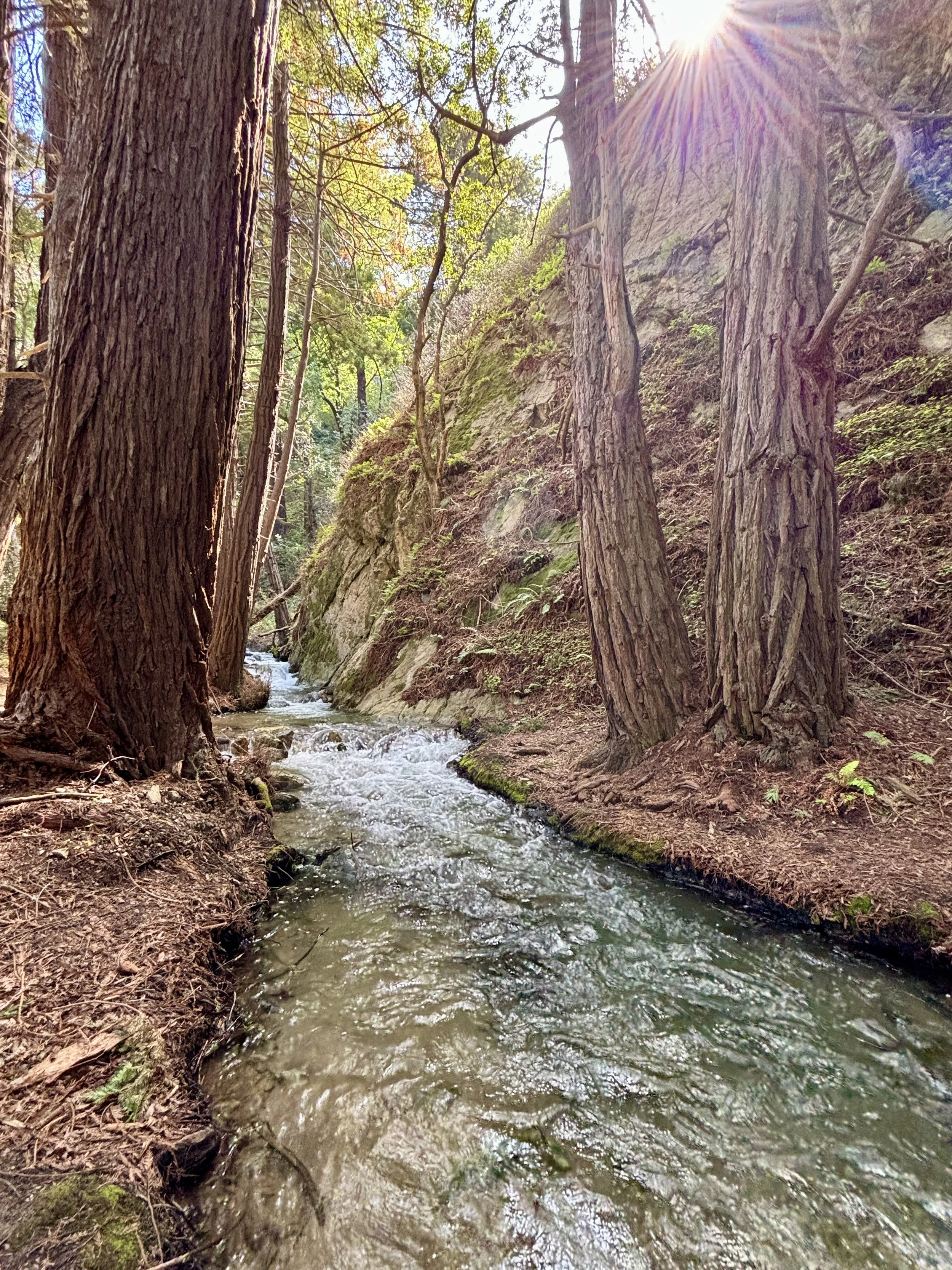


The trail begins at the green gate with the Partington Cove sign just inside the gate. A dirt road will descend into the canyon. After a short walk downhill you’ll get a view of a beautiful secluded cove. The views get better. Keep walking down the trail where the trail splits. A single track trail heads left…take it. You’ll find Partington Creek flowing to the ocean. Follow the trail along the creek downstream. If the creek is flowing good you’ll see some good views. The creekside trail makes a loop and meets up with the original single track near the road. Follow the road down canyon.
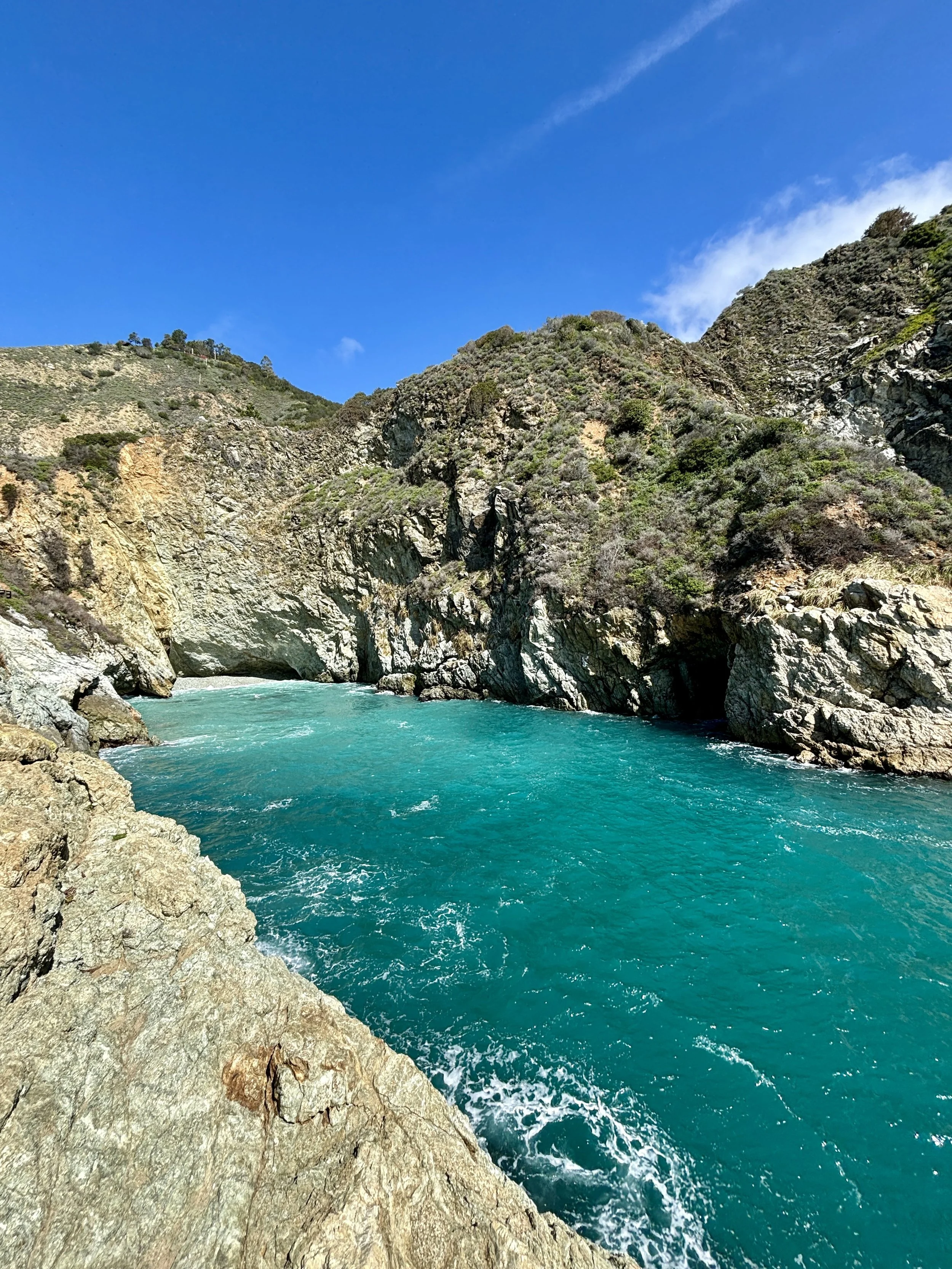
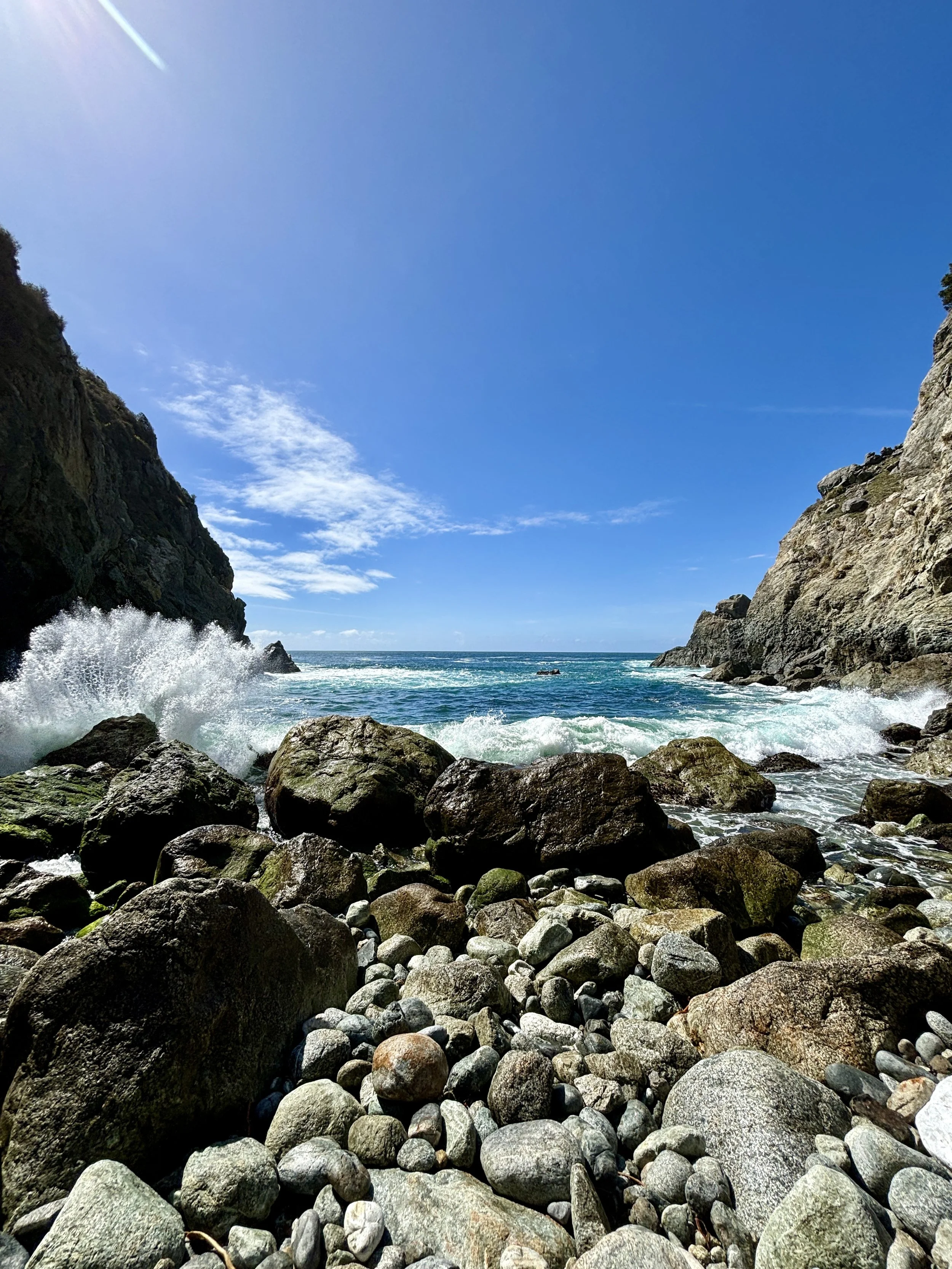
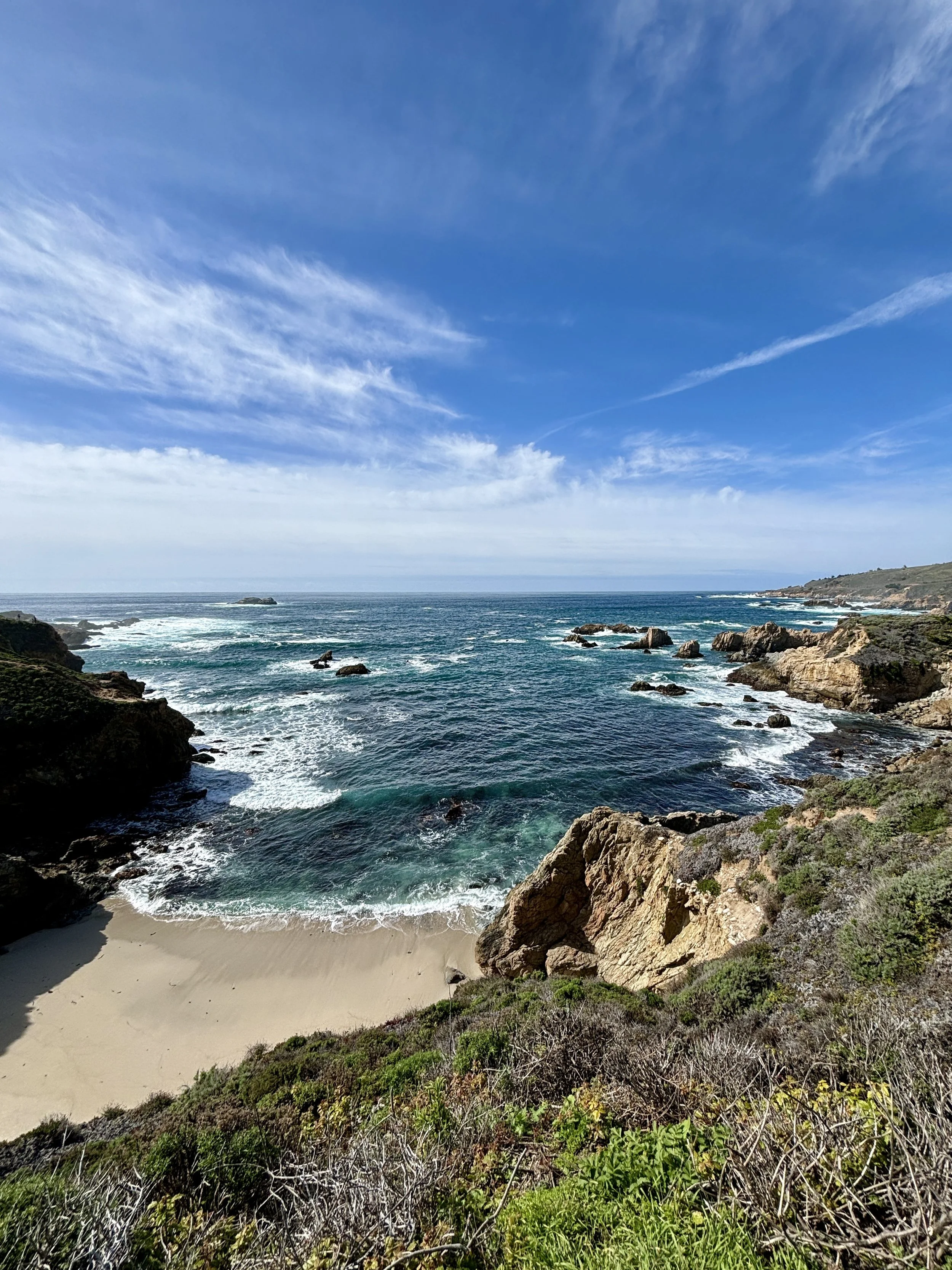
If you continue down canyon, along the creek, the trail will take you to the cove you saw from above. A beautiful cove made of steep rocky cliffs and a harsh rocky beach. The ocean is rough and can be dangerous. This is not a spot to get into the water, but it is a great spot for lunch and a few cool pics.
Once you’ve had enough of the cove, follow the trail back up the hill. Cross the bridge on the right and follow the path to the old tunnel. More than 100 years old, this tunnel was made by John Partington in the 1880’s to transport materials from the mountains to the ships anchored in Partington Cove. Walk through the tunnel and emerge at Partington Cove, a breathtaking cove between the steep cliffs showing off the light blue waters, and an incredible view south, along the cost. Enjoy your time here, take more pictures and be safe if you walk along the cliffs.
The walk back up to the highway is short and fairly steep but totally doable. This hike should take about an hour or so, depending on how much time you spend taking in the views and your fitness level. Once back at your car, make the short drive south on Highway 1, about 2 miles to Julia Pfeiffer Burns State Park for the third hike of the day, McWay Falls.
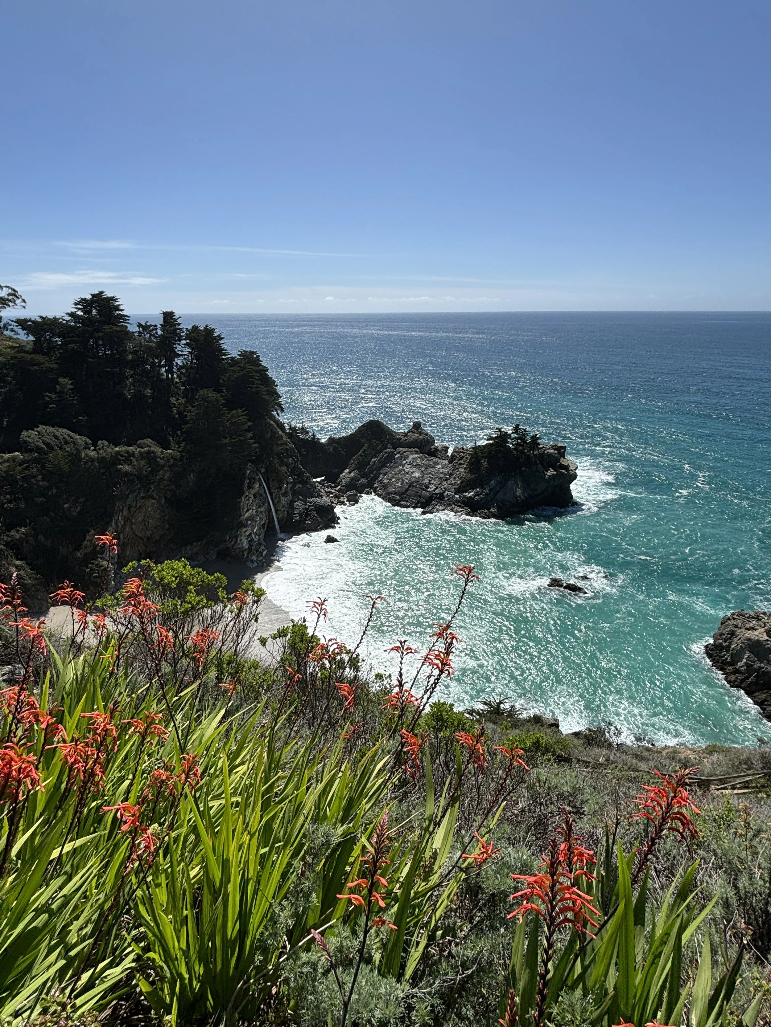
McWay Falls - Julia Pfeiffer Burns State Park, is your third location of the day. It’s very easy to find off Highway 1, but just in case, here’s a Google Pin to McWay Falls Trailhead. Turn into the state park for parking, restrooms, water and park rangers. The cost is $10 per vehicle to park, unless you have your parking receipt from Pfeiffer Big Sur State Park, then parking is free. Parking can be limited, especially on weekends.
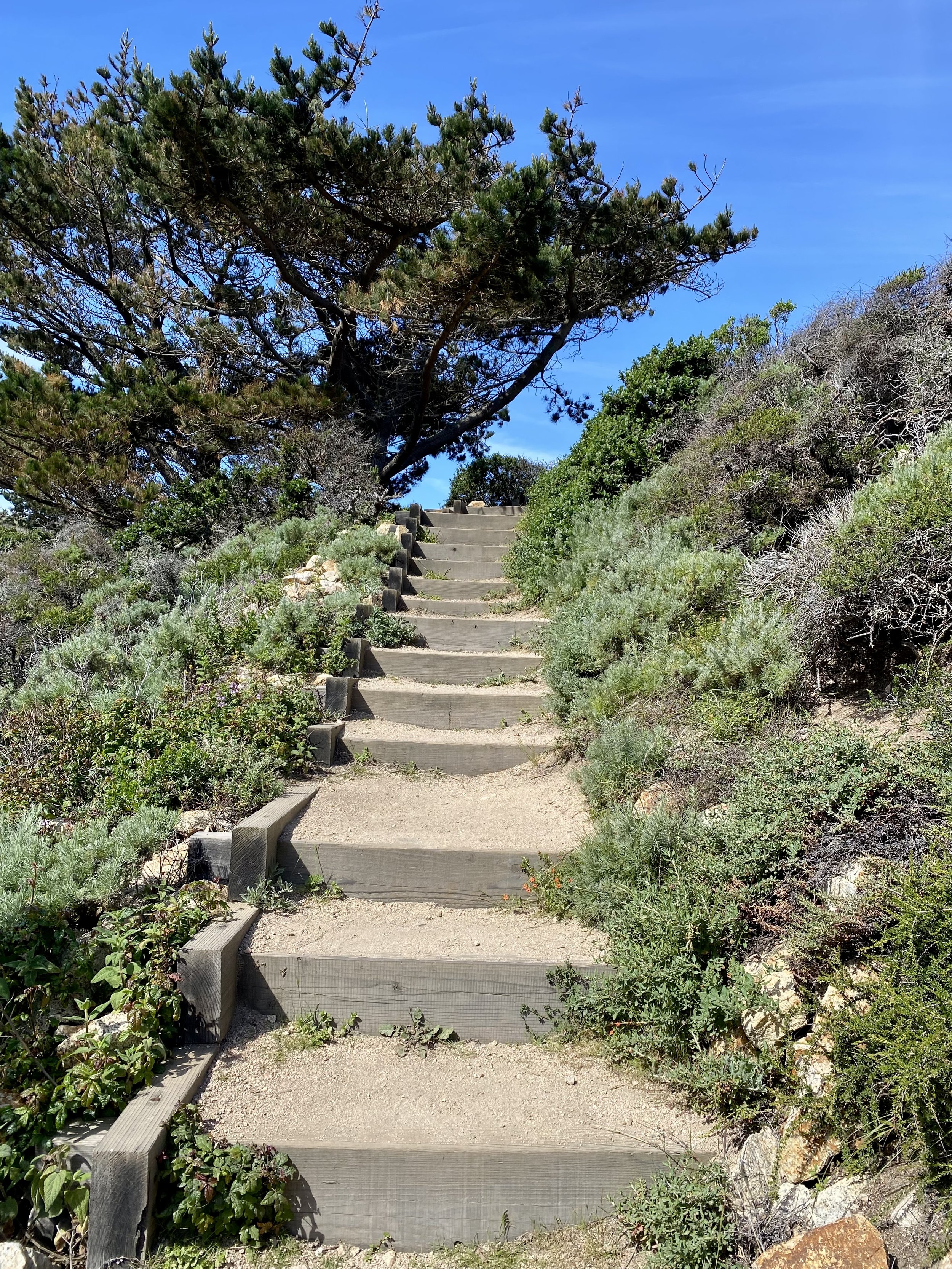
Most of the trails on the east side of Highway 1 are closed to hikers and backpackers. Currently, the Waterfall Overlook Trail is the only trail open at this location. A short walk along the trail from the parking lot, through the tunnel will take you to the view point above McWay Falls, an 80’ waterfall that flows year-round from McWay Creek to the Pacific Ocean. This is a very popular location and can get very crowded.


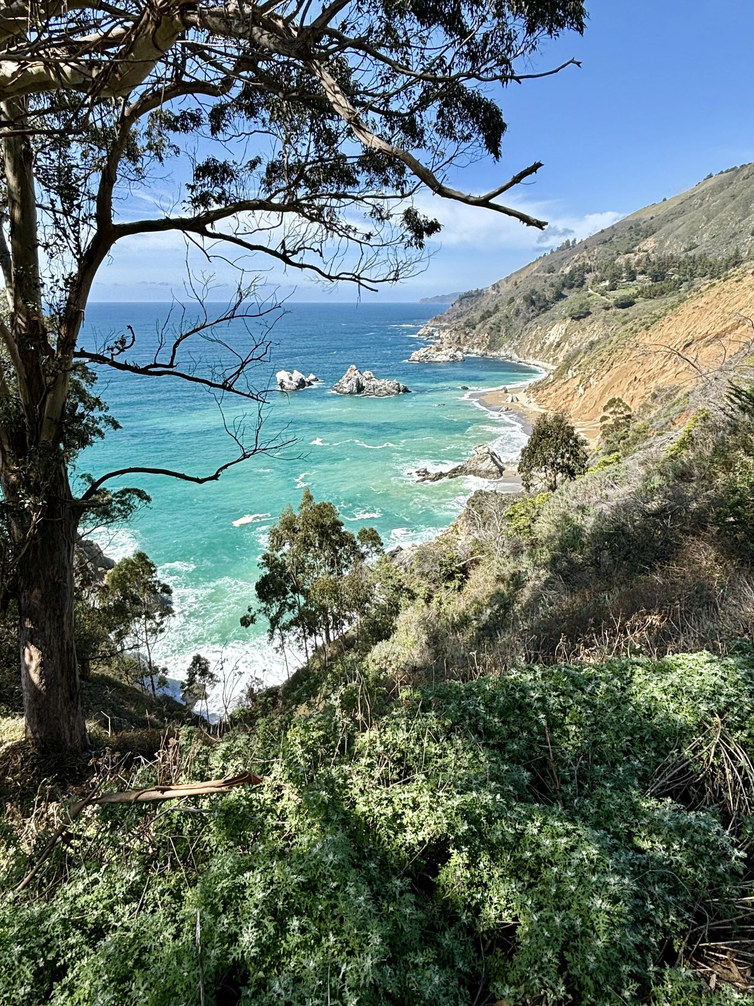
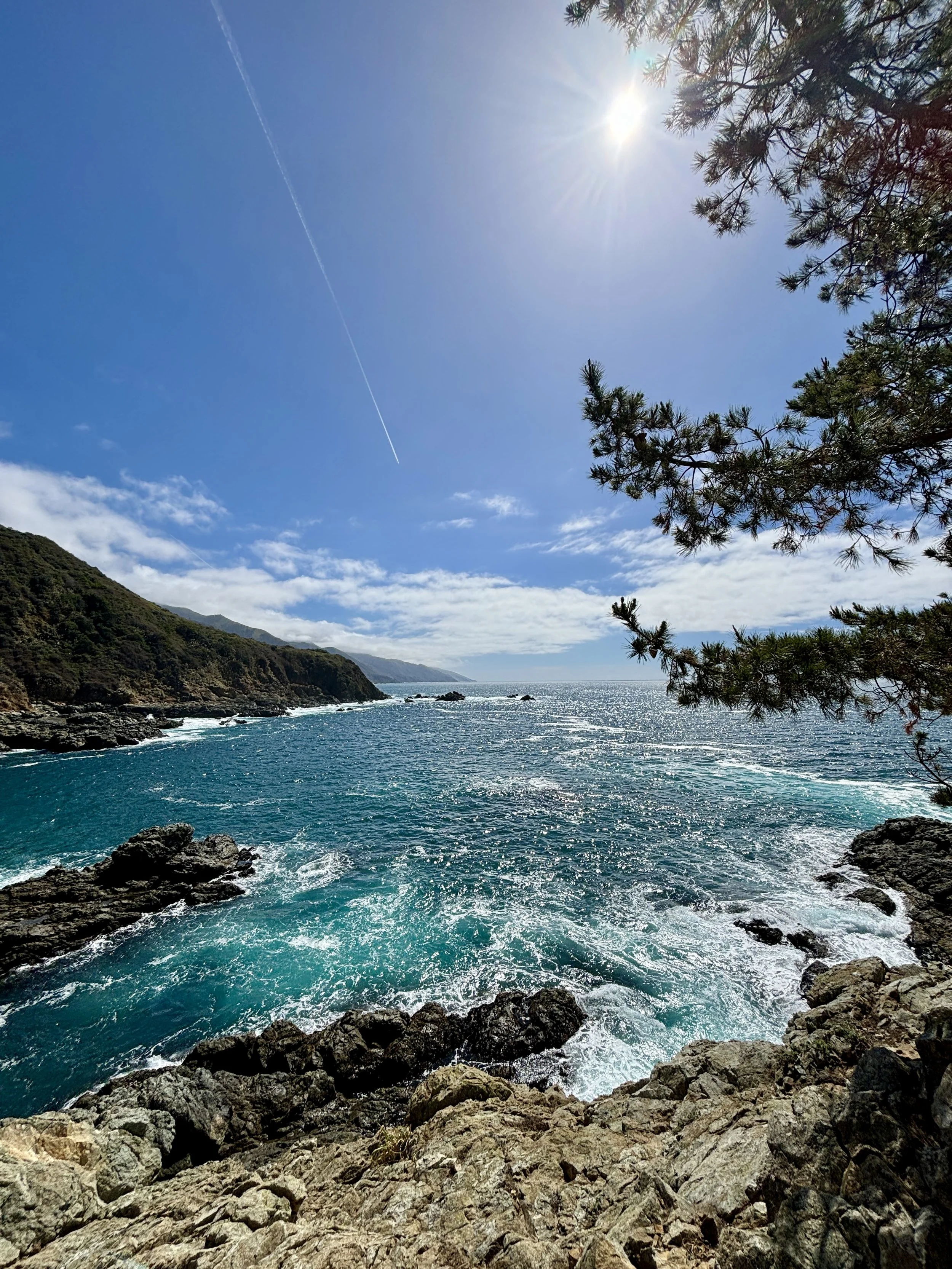
If you find the parking lot full or the crowds too much, carefully walk the highway north, to an alternate viewing area along the highway in a large dirt turnout. There’s more room here to view McWay Falls without fighting the crowds. Also, continue walking north along the highway to a great viewpoint of the coast to the north. Here you’ll find a great view of the coastline to the north. Many people never stop to explore past the Waterfall Overlook Trail and miss out on this beautiful view.
This hike will take maybe an hour. You’ve gone as far south on Highway 1 as you can. A short drive south will bring you to a roadblock. Highway 1 has fallen into the ocean due to a landslide happening in the winter of 2023. Turn around and head north about 30 miles to the Soberanes Point Trailhead, your final hike of the day.
You may want to make a couple of stops on your way north. If you’re hungry, check out Nepenthe, a great place to take in the vibe of Big Sur, grab some good food and a drink, plus the views from the patio are pretty awesome too. There’s plenty more places to stop but one I’ll feature is the famous Bixby Bridge. Completed in 1932, Bixby Bridge is one of the highest bridges of it’s kind. Made of concrete, Bixby Bridge spans 714’ in length across the canyon and 260’ above Bixby Creek. Built by hand before Highway 1 was paved, Bixby Bridge is known as the bridge to Big Sur.
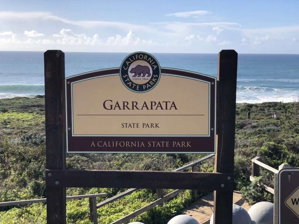
Soberanes Point Trailhead is also located along Highway 1. It is just north of Garrapata State Beach and is within the Garrapata State Park. There is no parking lot. Parking is difficult at this location. Along side Highway 1 in dirt turnouts, parking is limited and can be dangerous. Use extreme caution when parking and crossing the Highway. There are Porta-Pottys located on the east side of Highway 1. There are no other services at this location. This Google Pin will get you to Soberanes Point parking area.
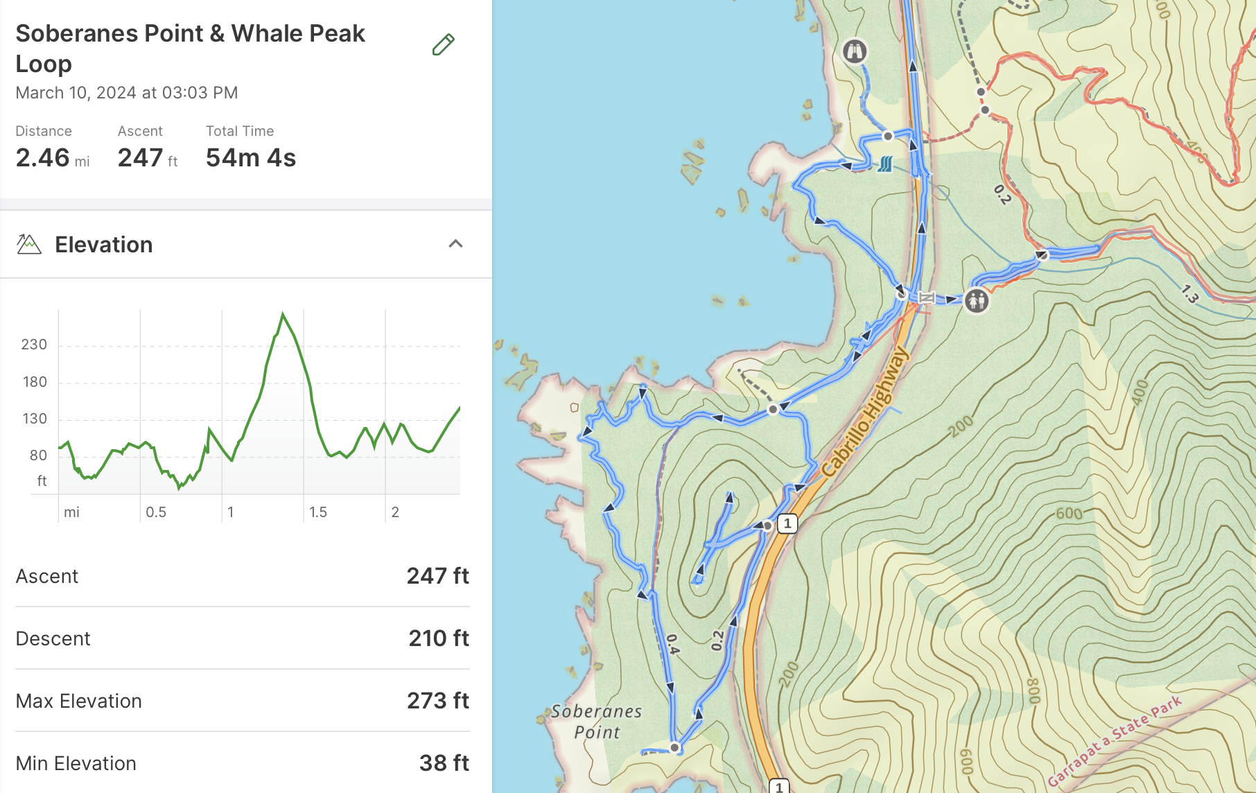
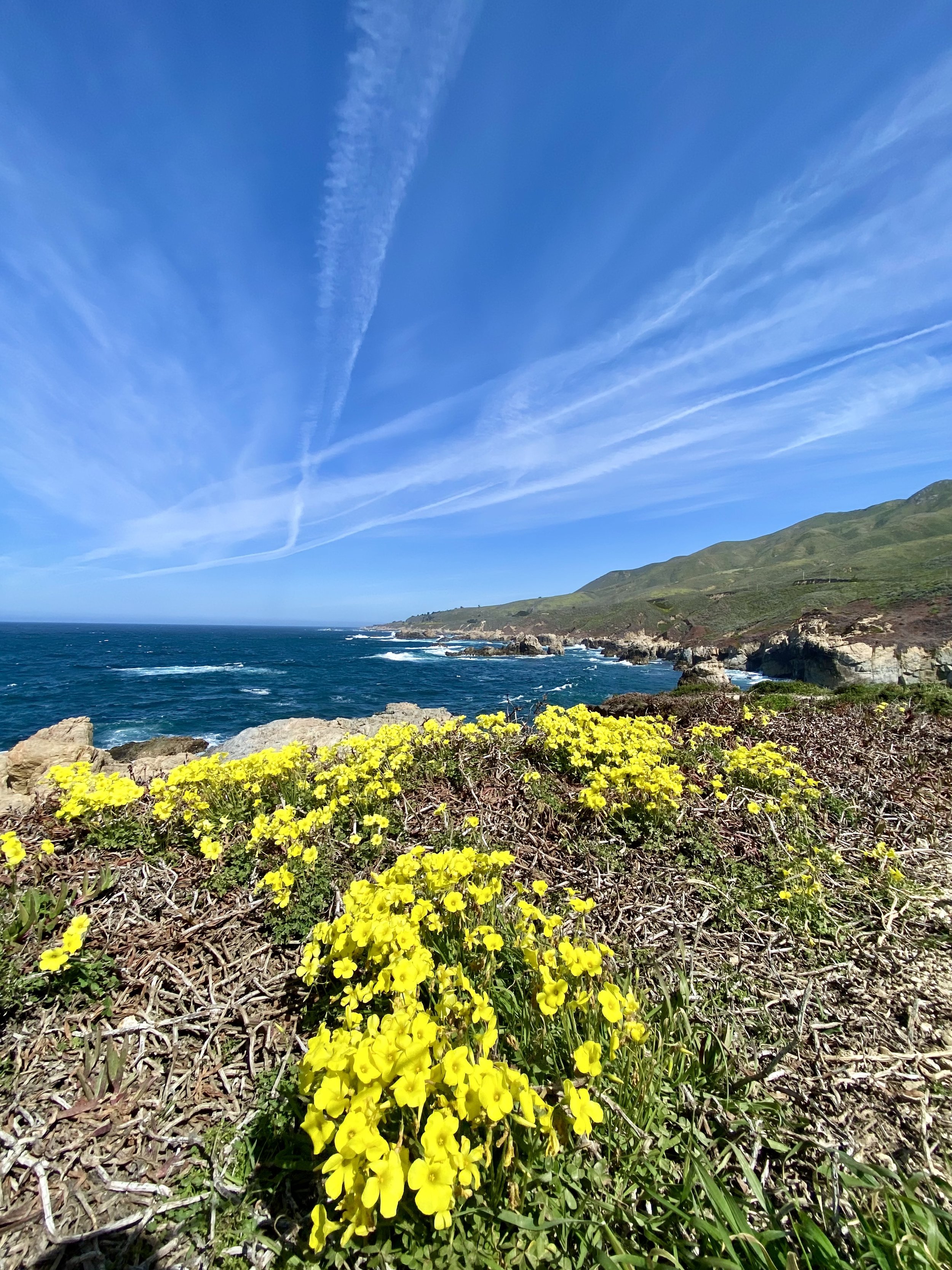
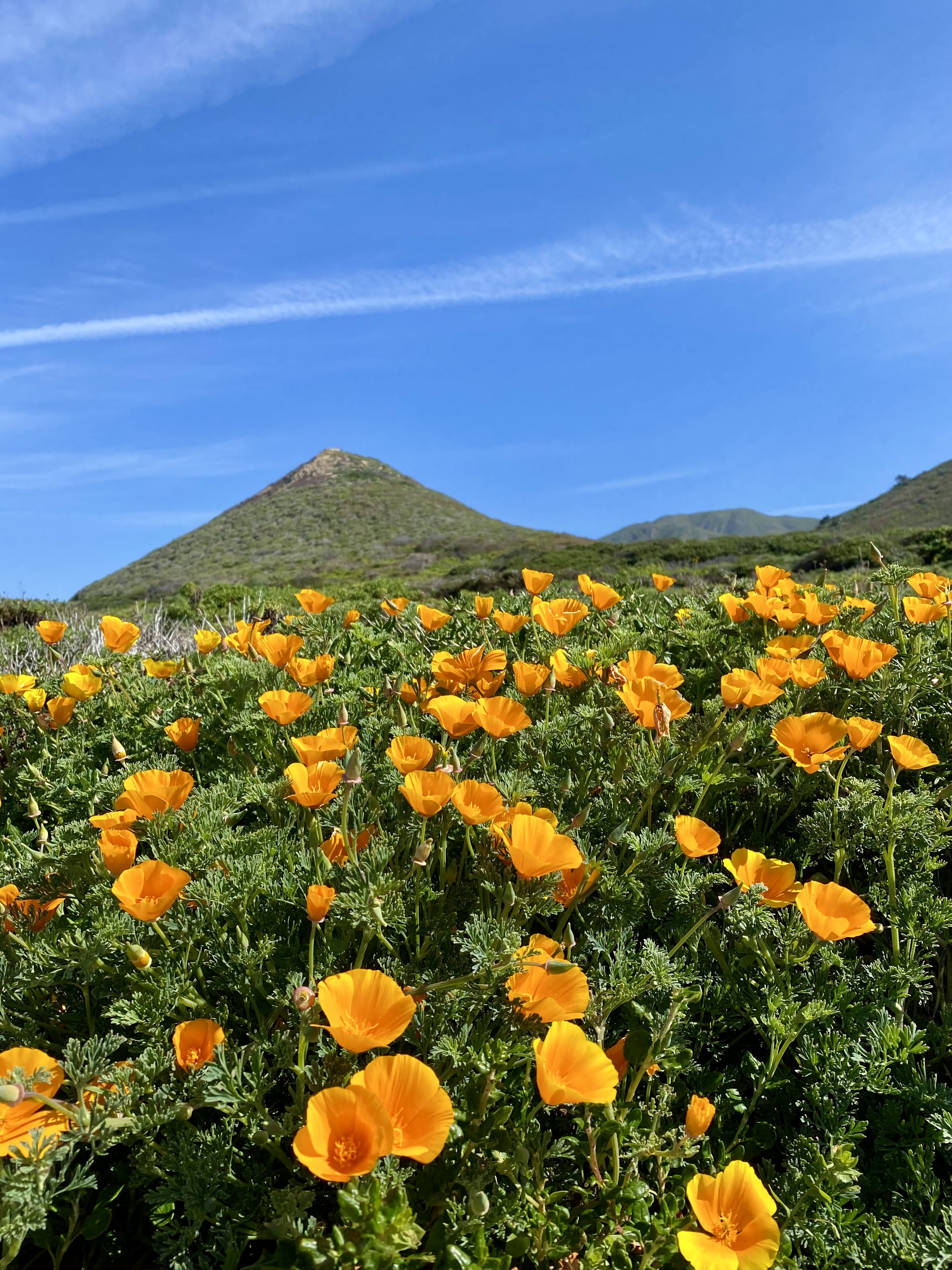
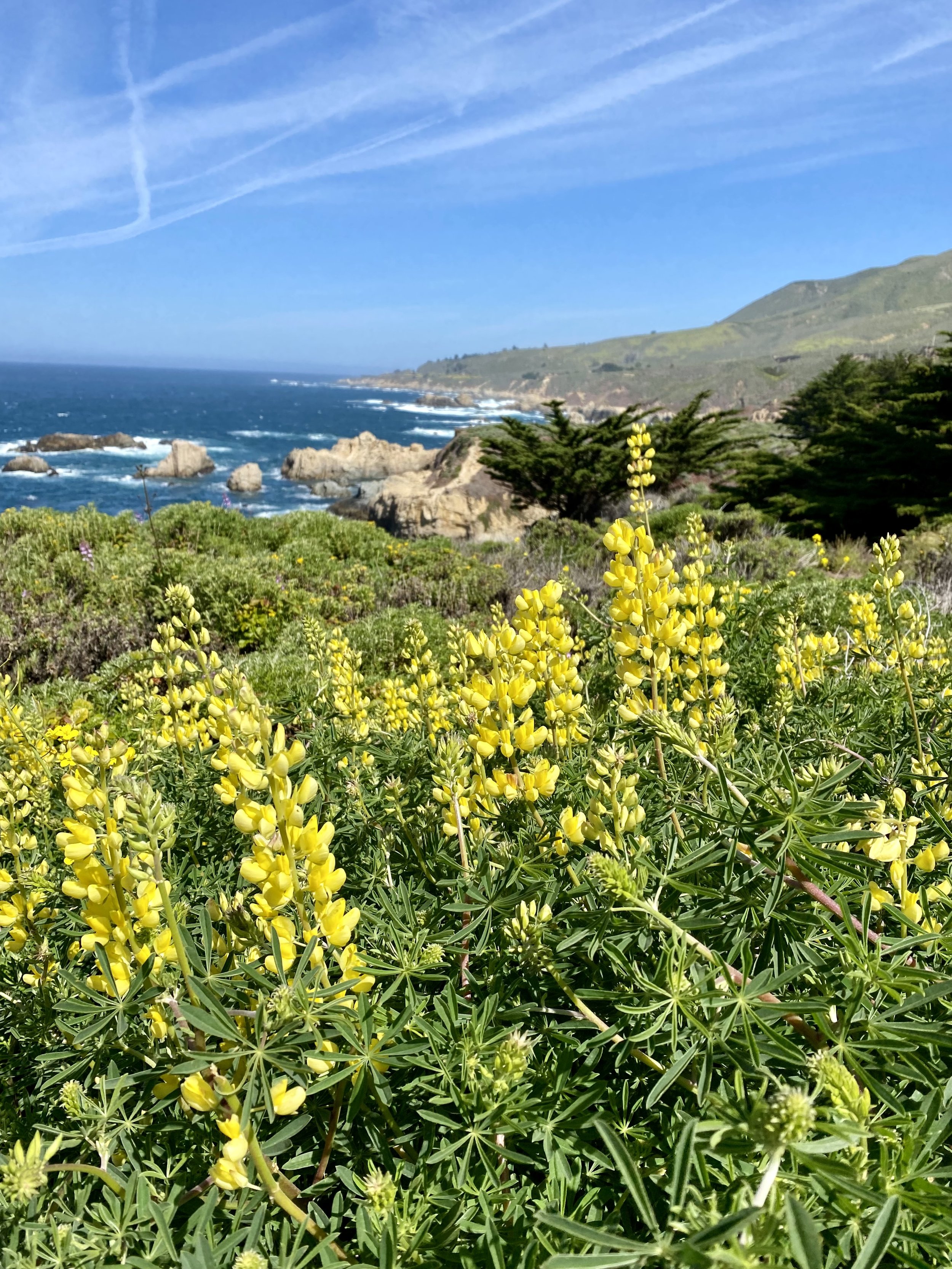


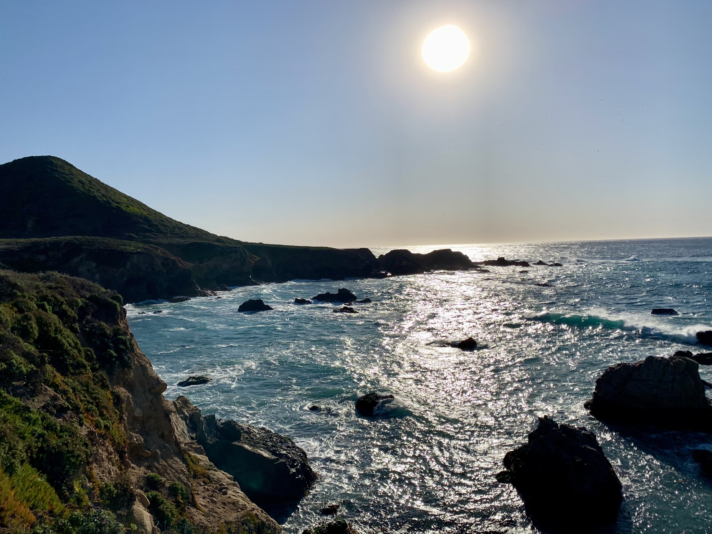
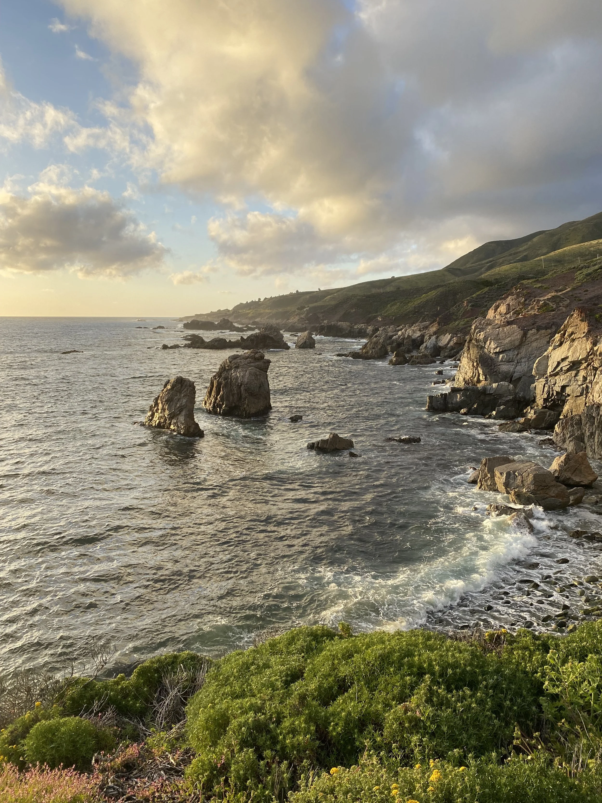
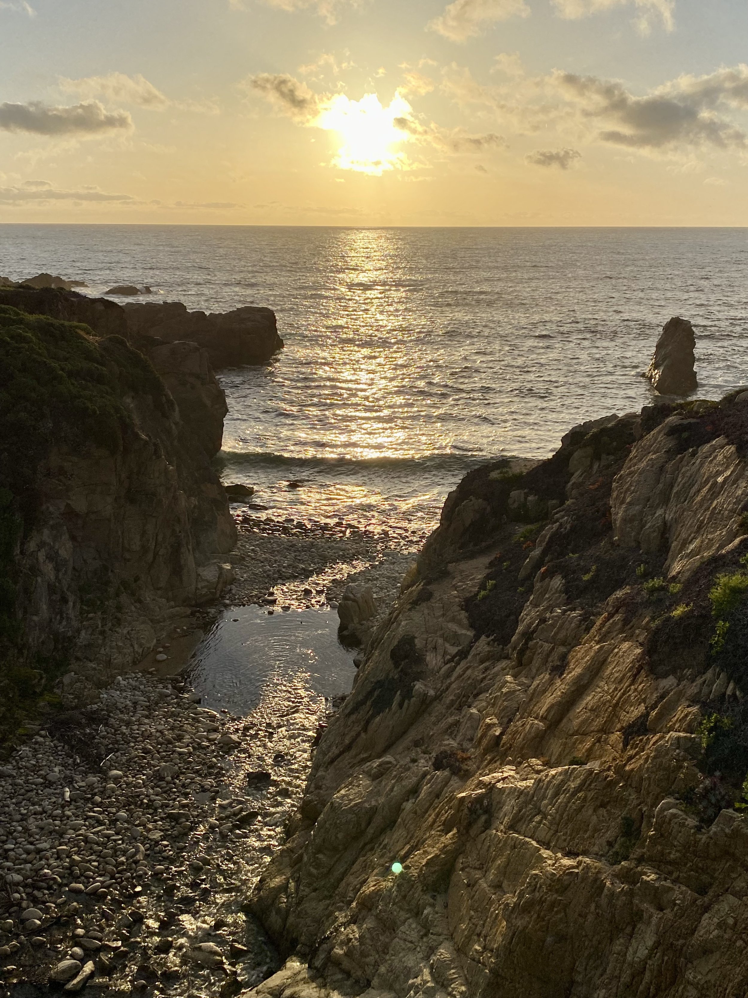
The Soberanes Point Trail starts on the west side of Highway 1 and is about 2.5 miles with about 250’ elevation gain if you hike up to Whale Peak. Follow the well travelled trail to the south west along the coast. You’ll see beautiful views along the coast to the north and to the south. Climb the stairs on the south side of the peak to reach a 360 degree view point atop Whale Peak. It’s definitely worth the short climb. Complete the loop trail but before going back to your car, follow the trail to the north along the coast for more great coastal views and find the Soberanes Creek meeting the Pacific Ocean not far from where you began. Locals tip…sunsets are the best time to be at this location.
Depending on your plans, you can stay at Soberanes Point for sunset or creep up the coast to more of the beautiful locations for dinner, drinks and even sunset, as time allows. Carmel is full of great restaurants to meet any taste. Give some a try.
Three state parks and 4 easy popular hikes in one day on the Big Sur coast makes for a good day. There is so much more to do along the route discussed. You can visit some of Big Sur’s incredible restaurants, coffee shops and deli’s or even stop at a few of the museums and shops along the way. There’s a few more state parks on this route, two that offer great beaches. Roadtrips are always epic down the Big Sur coastline. I’ll feature more locations down the coast and I hope you got something out of the “Dirt” on these trails. ✌🏼😎🤙🏼