
Pinnacles National Park
Juniper Canyon to High Peaks Trail Loop


📍Pinnacles National Park, the 59th named U.S. National Park, found on the border of Monterey and San Benito counties is our closest National Park. Pinnacles was named a U.S. National Park on July 10, 2013 but was formed somewhere between 23 and 25 million years ago. Its “birth place”, so to speak, is roughly 195 miles south of its current location, near Lancaster CA. Briefly, the science of geology tells us that Pinnacles was formed when two geologic plates collided forming a volcanic zone. Volcanoes grew and changed the land where they started. Through time the volcanoes came to “die” or become dormant. Another geologic plate, the Pacific Plate, became active but not in the same was as the first, nor in the same direction. This zone moved against the other, sliding northwest, causing the volcanic area where the Pinnacles were formed to split and slide away from this location. The volcanoes eroded and formed the landscape we see today, in the location we visit today. Ironically, the Pinnacles will continue to evolve and continue to move in the same direction they have been moving, along the San Andreas fault to the northwest. You can learn more about the formation of the Pinnacles, as we know it today, by clicking this link to visit the Pinnacles NP home page.
Being a National Park, Pinnacles is truly amazing. What you can expect to see is Pinnacles chaparral, oak woodlands, and canyon bottoms. Hikers enter rare talus caves and emerge to towering rock spires teeming with life: prairie and peregrine falcons, golden eagles, and the inspiring California Condor. You’ll also see squirrels, chipmunks, lizards, snakes, possibly coyotes and maybe even a mountain lion, among many other unique sights.
Pinnacles NP is located on the border of Monterey and San Benito counties. There are two sides to the park with two separate entrance locations. You cannot drive through the park but you can hike from side to side. Click this link for Directions to Pinnacles NP. The physical address of the park is 5000 East Entrance Rd., Paicines CA. This would be the San Benito entrance. Here you’ll find camping, RV sites, a small general store and visitors center and the trailheads to the east side of the park.
You can enter the NP on the Monterey County side by traveling to Soledad, CA and taking Hwy 146 to the park boundary. You’ll also find the West Pinnacles Visitor Contact Center and trailheads to the trails on the west side of the park. There is no camping or RV sites and no general store on this side of the park. This is the side of the park I frequent most as it’s closest to home. This blog will focus on two popular trails on the west side of Pinnacles NP.
Pinnacles (west side-Monterey County) is open from 7:30am to 8pm, day use only. Camping is prohibited on this side of the Pinnacles. The West Pinnacles Visitor Contact Center is open from 9am to 3pm. The usual National Park fees apply. Parking is limited and fills quickly. The West Pinnacles Visitor Contact Center is about a 2.5 mile drive to the main parking area, the Chaparral Parking Area. Here you’ll find parking, restrooms, water stations, picnic benches, garbage and recycle bins and the trailheads. If this parking lot is full, the Jawbone Parking Area is about a .5 mile drive back towards the entrance. A walking trail connects the two parking areas.
⛰️A favorite trail, and the focus of this blog post, on the west side starts at the Chaparral Parking area. The Juniper Canyon to High Peaks Trail is about a 4.5 mile loop trail with about 1200’ of elevation gain. The trail is rated as difficult and is a well travelled, mostly single track trail on dirt and rock. This trail should take about 2.5 to 3 hours to complete. Follow the signs from the parking area to the trailhead, a short distance away.
The weather can change quickly. It can get dangerously hot at the Pinnacles. Plan for sun. If it’s chilly in the morning dress in layers, bring a hat or sunshade, sunscreen and plenty of water. Carry and drink at least one liter of water per person per hour of hiking. Water is not available on trails. Trail snacks and electrolytes are also recommended.

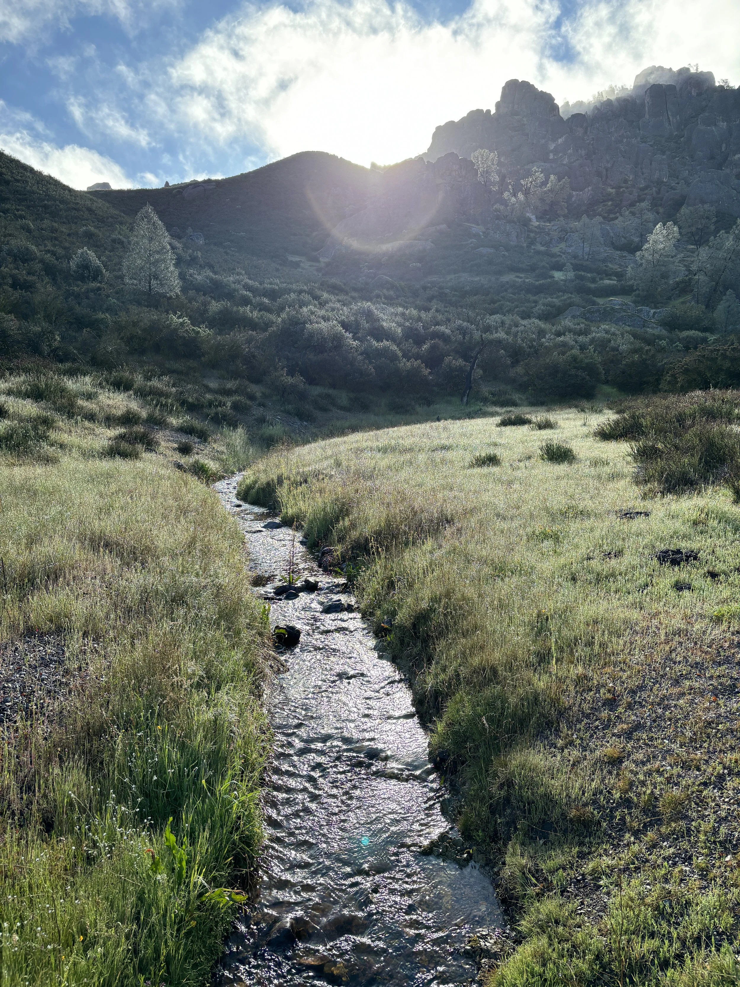
🥾The Juniper Canyon to High Peaks Trail starts at the Chaparral Parking Area. Walk east, opposite the restrooms to find the trailhead. As mentioned above, if you hike during the spring you may have to cross the West Fork Chalone Creek and other small tributaries that add to the beauty during the spring. These creeks and tributaries will dry up quickly and the trail will be very dry during the summer and fall. The trail gently ascends towards the High Peaks but first you’ll enjoy an easy walk along the creek among the wildflowers and the start of the volcanic boulders that have found their resting spot below High Peaks.
It won’t be long before you’ll stat to gain elevation as you start up the switchbacks. The terrain changes from an easy drainage with wildflowers to large volcanic boulders, wildflowers and brush. Each turn of a switchback gives way to beautiful views of the unique rocky landscape.
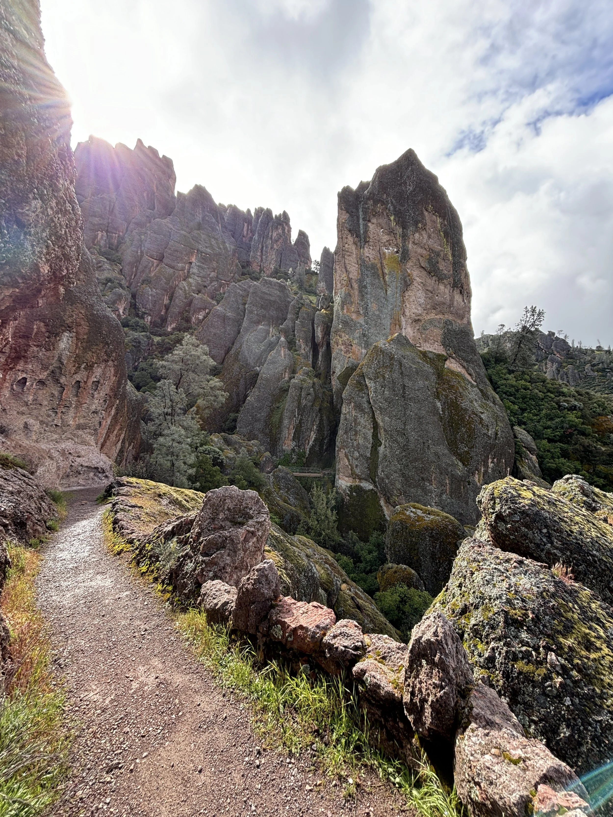
A little over a mile up the trail you’ll come to a “Y”. Left takes you to Tunnel Trail, right keeps you on Juniper Canyon Trail. I recommend staying right. Continue up through the large rock spires. Take in the views and enjoy the wildflowers. Soon you’ll emerge at the ridge top, the High Peaks Trail. You’ll be met with views of San Benito County, looking down canyon towards the east side of the park. There’s a bench and pit restrooms if you need a break.
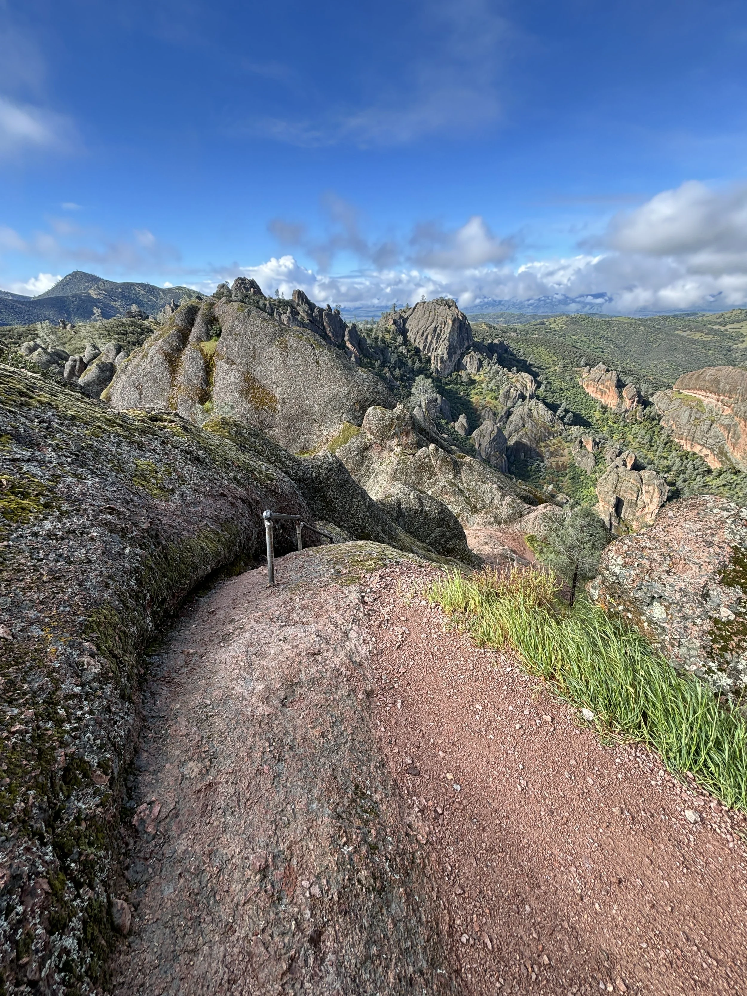
The High Peaks Trail splits at the top. The right side of the trail will head downhill towards the east side of the park. The left side of the trail stays on the ridgeline and heads towards the northwest. Take the left High Peaks Trail. Follow this trail along the ridgeline and take in the views below you. Soon the trail will drop over to the east side of the ridge and open views of Condor Gulch down to the Bear Gulch area of the east side of the park.
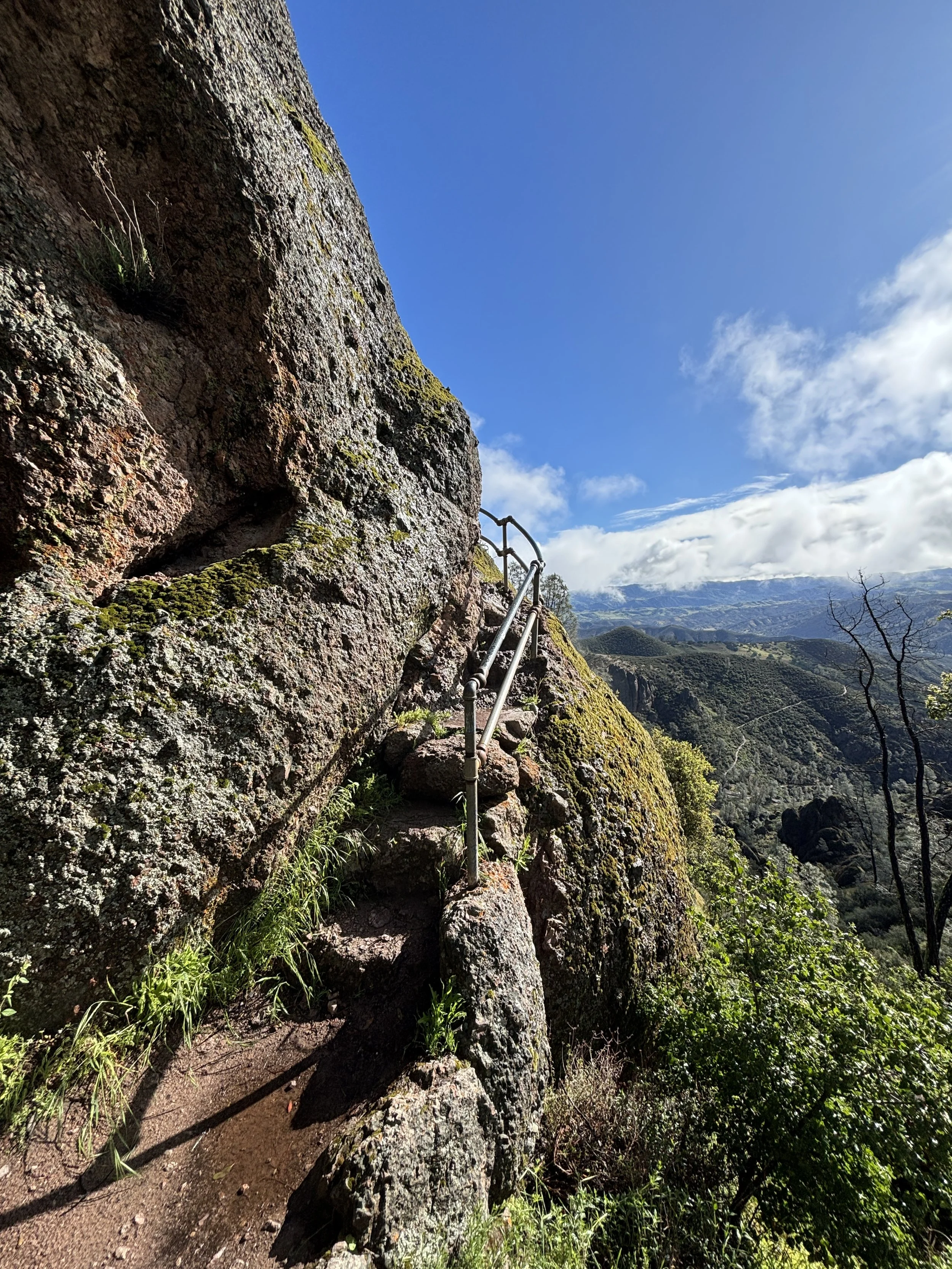
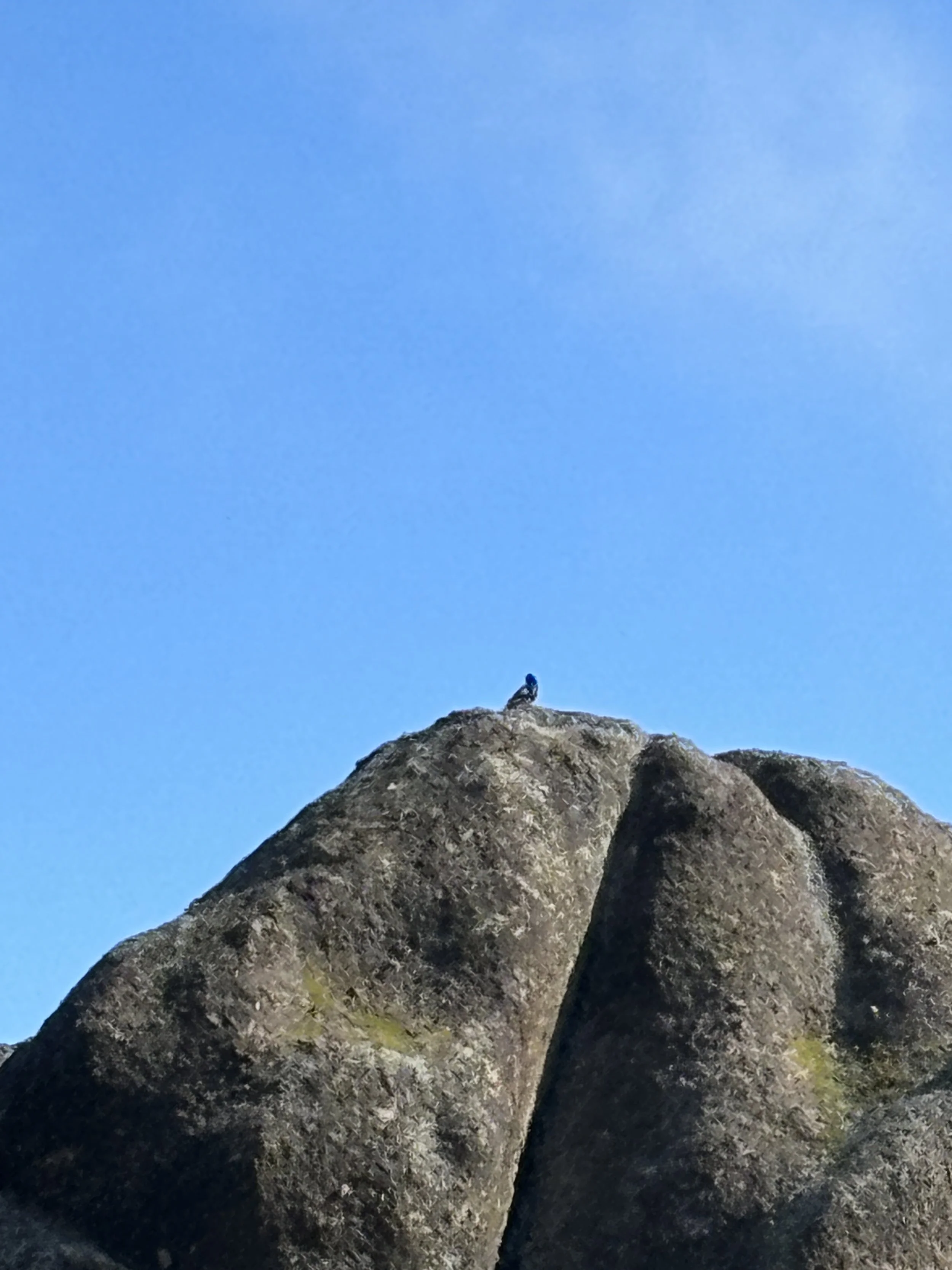
You’ll notice the trail change from dirt to rock. The trail is easy to follow but watch your step! Speaking of steps, you’ll begin to see steps cut into the rock formations. Follow them. Soon the steps will get steep and handrails will appear. This is the High Peaks portion of the park. You’ll find the trail begins to emerge on large rocks with steep drop-offs. Keep an eye out for the large birds flying in the updrafts created by the sun and terrain, allowing them to fly close to the cliffs, and you. You may get a close up view of a California Condor. These massive birds call Pinnacles home. It’s a rare sight so if you see one, take a picture and do not disturb them.
Continue through the High Peaks trail, up the steps, across the bridges, down the rocks and up again. Take your time, watch your step and take many breaks to take in the views. It’s a special area of the park.
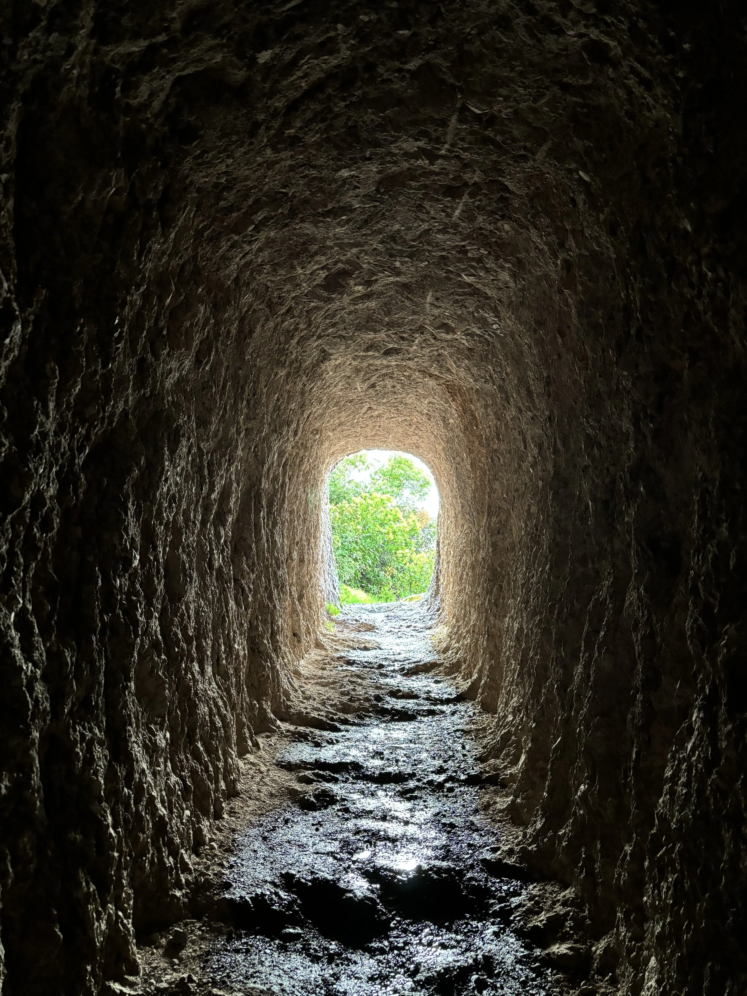
Soon the trail will split again. Follow the Tunnel Trail downhill to the left, instead of continuing on the High Peaks Trail. The Tunnel Trail creates a loop back to the Juniper Canyon Trail but not before revealing more spectacular views and the trails namesake, the tunnel.
You’ll hike back and forth downhill through switchbacks, often coming upon steep corners with amazing views of the other side of the High Peaks area of the park. Soon you’ll descend into a canyon, cross a bridge and enter the tunnel. The tunnel is about 150’ long man-made tunnel through the rock. It’s a great place to cool off and take some fun pictures inside the tunnel. Continue through the tunnel and you’ll likely carry on downhill back onto the Juniper Canyon Trail without even knowing it or you may notice a familiar location, the one you saw coming up the Junpier Canyon trail. This time, as you’re descending back to the parking area, stay to the right and continue downhill. The trail will take you back to the parking area where you can get some rest and take in the High Peaks from the parking area.
You’ve completed the Juniper Canyon to High Peaks Trail at Pinnacles National Park. If you have time and the energy, check out the 2.5 mile out and back Balconies Trail to the Balconies Caves. The trailhead is near the parking area and will head west. It’s worth the effort, especially during the spring when the creek is flowing!
Pinnacles National Park is a very unique and special place to hike and enjoy nature, get some exercise and enjoy the closest National Park to home. I will feature the Balconies Trail to the Balconies Caves hike and the Bear Gulch area of the east side of the Pinnacles in upcoming blog posts. You can keep up with my RADventures by following @ur_radventures on Instagram. I hope you enjoyed the “Dirt” on this trail and follow along for more.