
Palo Corona Park-
Inspiration Point and Animas Pond
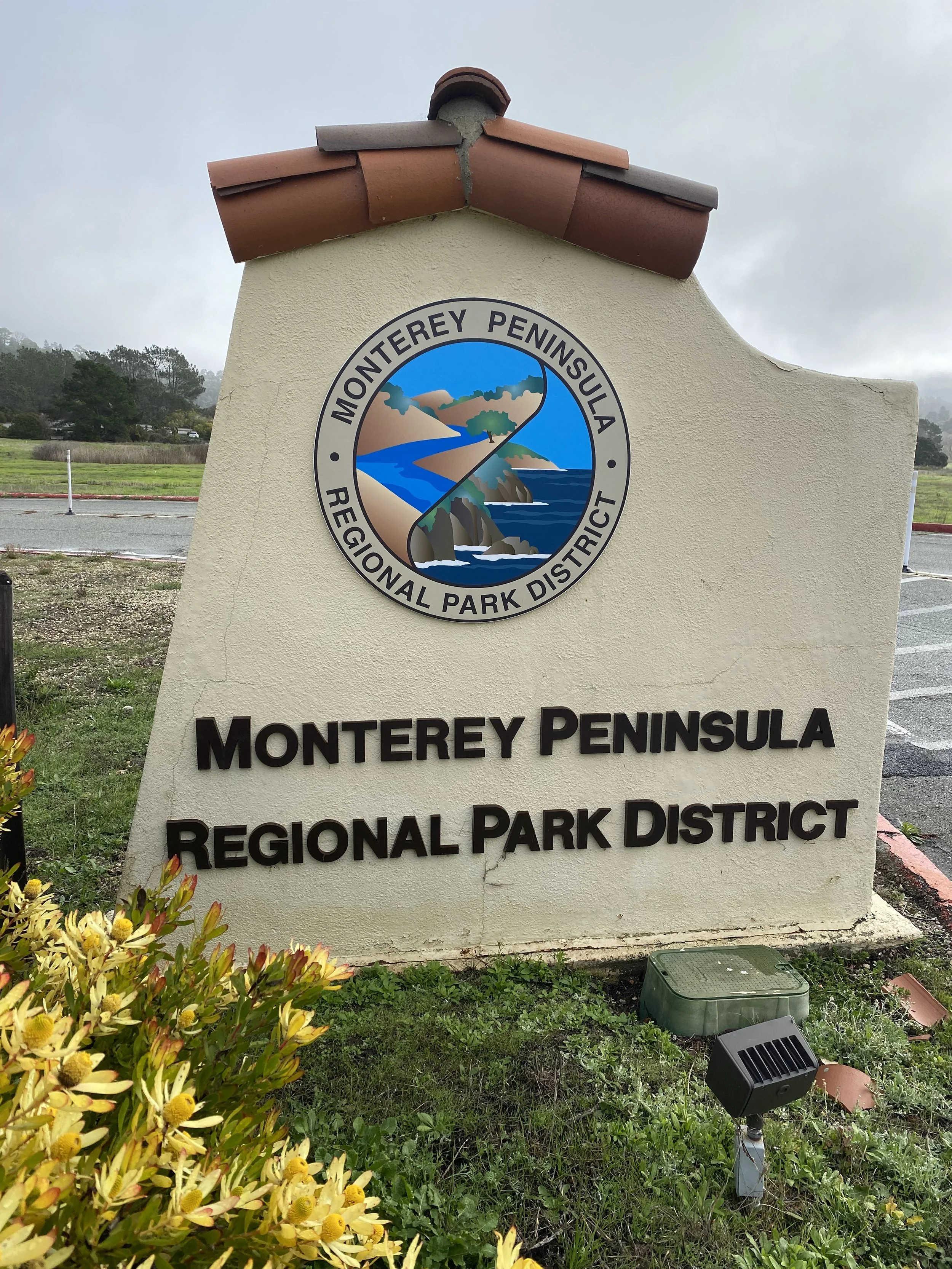


📍Palo Corona Regional Park is located near the Mouth of Carmel Valley. Through partnerships with many agencies, the Monterey Regional Parks District acquired several key pieces of undeveloped open space to form the nearly 10-mile long, 4500 acre park boasting an extraordinary mix of ecosystems and wildlife. Read more about the extraordinary history and development of the Palo Coronal Regional Park by visiting its website at the link.
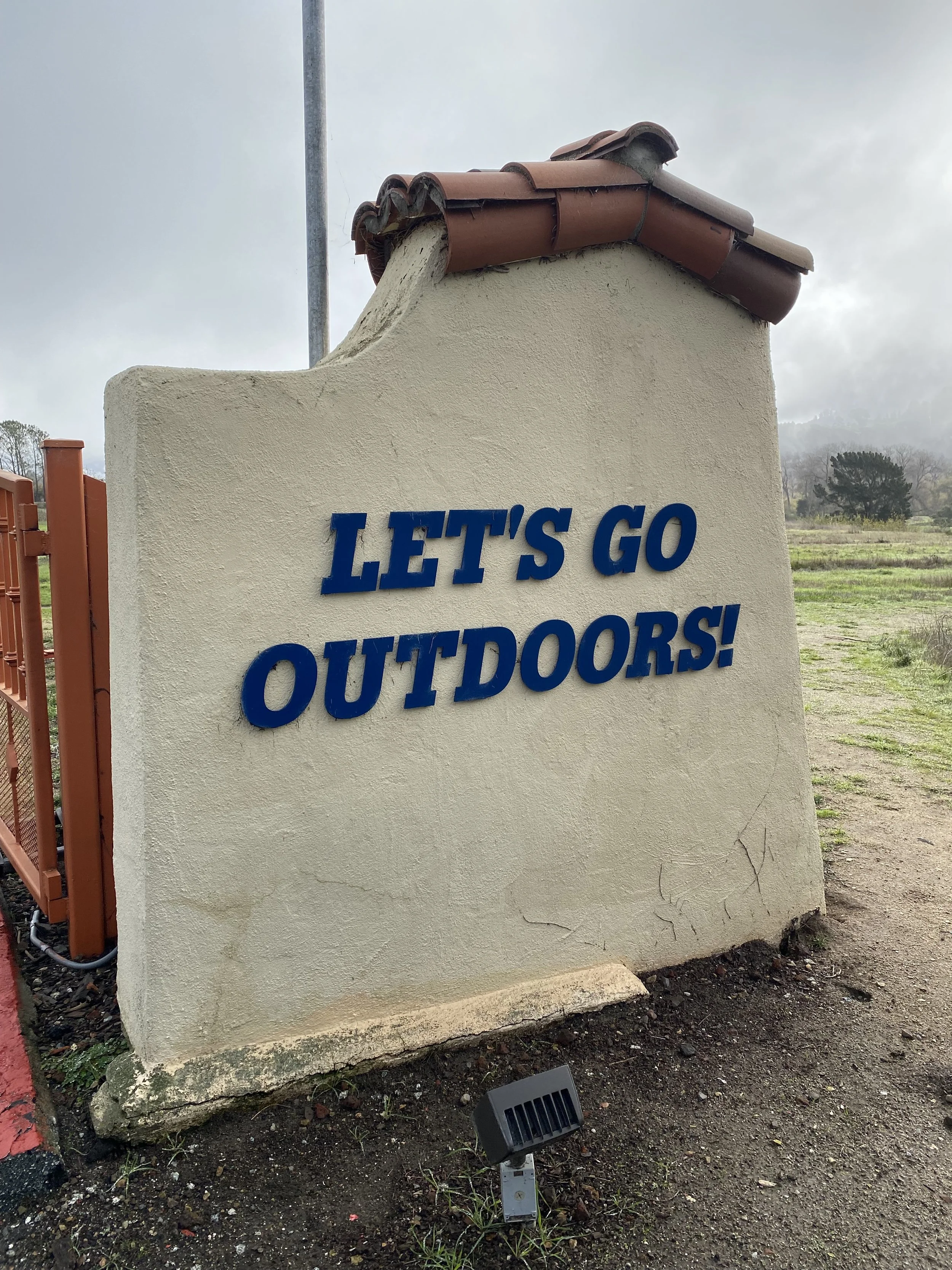
The parks main access point is located at the Palo Corona Access Point, the old Rancho Canada Golf Course, 4860 Carmel Valley Road. Here you’ll find ample parking to meet, clean restrooms, the Discovery Center and the District Headquarters. The park is open during daylight hours, from dawn ‘til dusk. No overnight camping is allowed. There is no fee to enter however permits are required to access at some points. Dogs are allowed on leash in the Rancho Canada Unit Only (See Map). Dogs are not allowed beyond this point and would not be allowed to accompany you to the Animas Pond. Check the parks website for park rules and regulations.
⛰The Palo Corona to Animas Pond hike starts at the Discovery Center. It’s about a 5.5 mile out and back hike with several alternate routes you can add to enjoy more of the park. This is a well travelled trail, well marked, mostly dirt single track and dirt road. The trail climbs about 600’ to Inspiration Point before ending at Animas Pond. I’d rate this trail as “Greenish-Blue” meaning moderate because of the climb…but it’s worth the effort. It’ll take a little over 2 hours to complete, depending on how long you stop to enjoy the views.

🥾This hike starts in the Rancho Cañada Unit, at the Discover Center, a small museum and information center at the District Headquarters building near the parking lot. Take the path just past the flagpoles and new restrooms. You may notice the trail is a cement path, similar to a golf course cart path. The Rancho Cañada Unit used to be Rancho Cañada Golf Course and Country Club, a 36 hole golf club. You can read more about the acquisition and transfer to Regional Park on the website. You may notice nature has been taking back the land from the once groomed, manicured and cared for golf course. This is just another example of the unique history of Palo Corona Regional Park.
The “cart path” trail winds downhill and meets the Carmel River. The beautiful bridges built over the Carmel River that allowed golfers to cross over the river to continue play, remain. Generally, during the winter and spring months the Carmel River flows from Upper Carmel Valley to the Pacific Ocean entering at the Carmel River Beach and Carmel Bay. A view you will enjoy from a higher perspective later on this hike. The trail continues to the back of the Rancho Cañada Unit where you’ll walk through a gate to traverse into the Front Ranch Unit. Dogs are not allowed past the Rancho Cañada Unit.
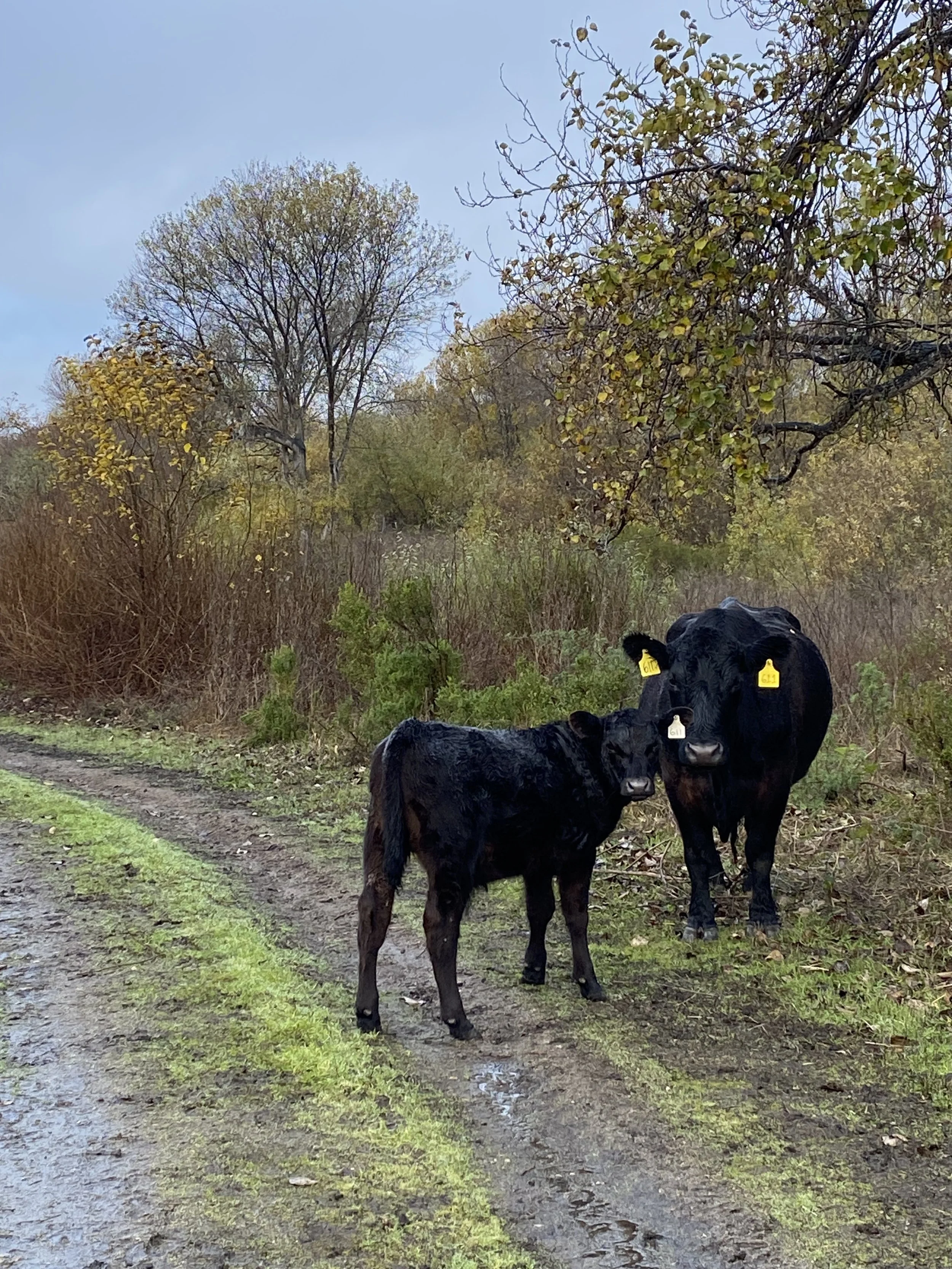
As you enter the Front Ranch Unit through a cattle gate you may be met by the locals. The Front Ranch is used for cattle grazing and the cattle often use the trails. Don’t mind them. They’re big, the calves are smaller, they both look ominous, maybe cute to some, but they are harmless. Let them know you’re walking through, don’t touch and carry on. They are very photogenic. Ask them to smile and only take a picture, not anything else.
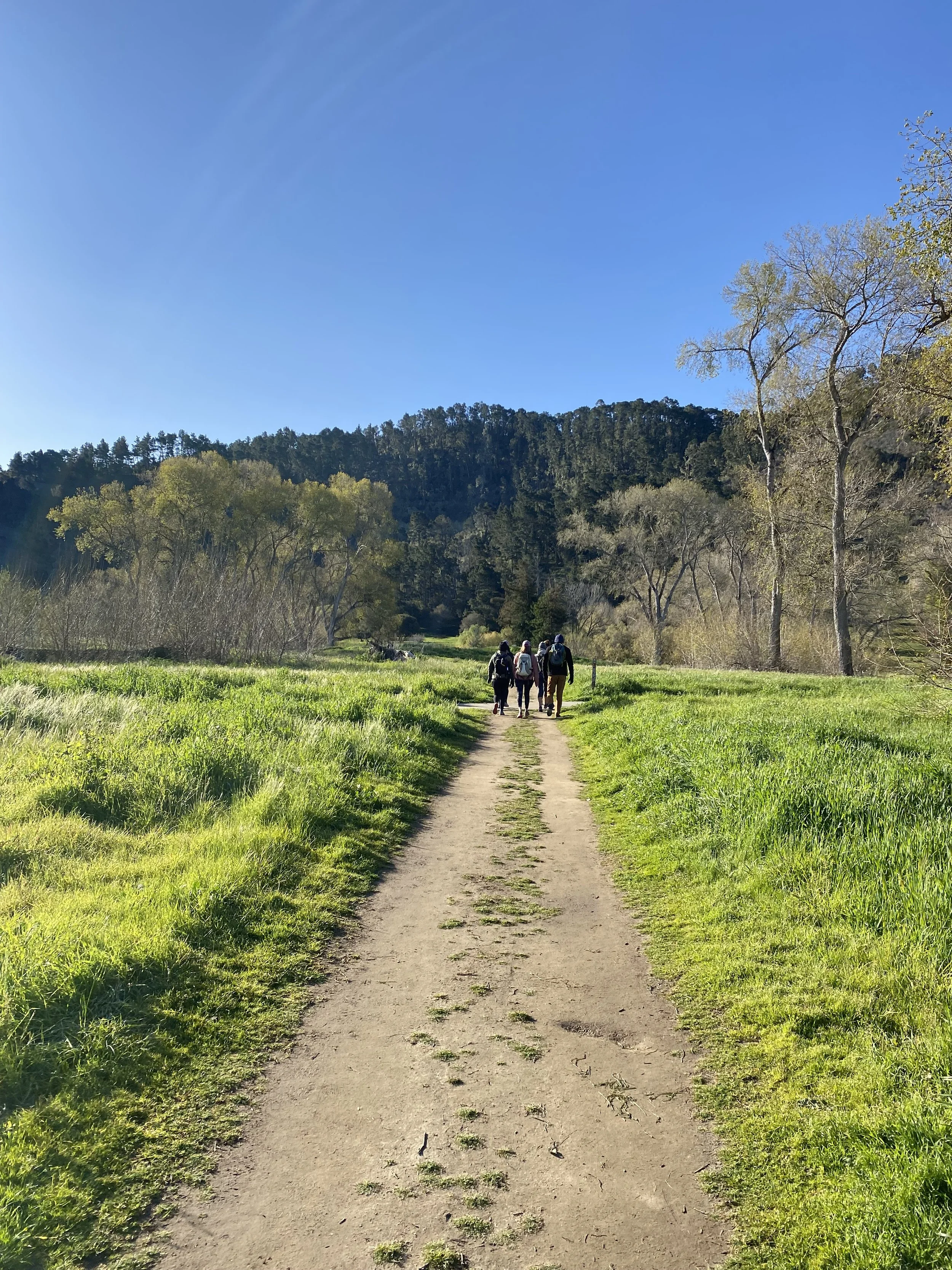
Follow the Vista Lobos Trail through another cattle gate to the Talus Trail. The Talus Trail, on the left, follows the toe of the slope separating the hillside from a beautiful coastal pasture. Here’ you’ll likely see more cattle, get a glimpse of the Pacific Ocean and the Carmel River Beach, maybe even some coyotes, bobcats, turkeys and deer. Listen for the hawks “talking” to one another. If the surf is big and you listen hard enough you may be able to hear the waves breaking on Carmel River Beach. Make your way along this peaceful oak covered trail to the “T” trail intersection, where you’ll see a bench and a “Porta-Potty”.
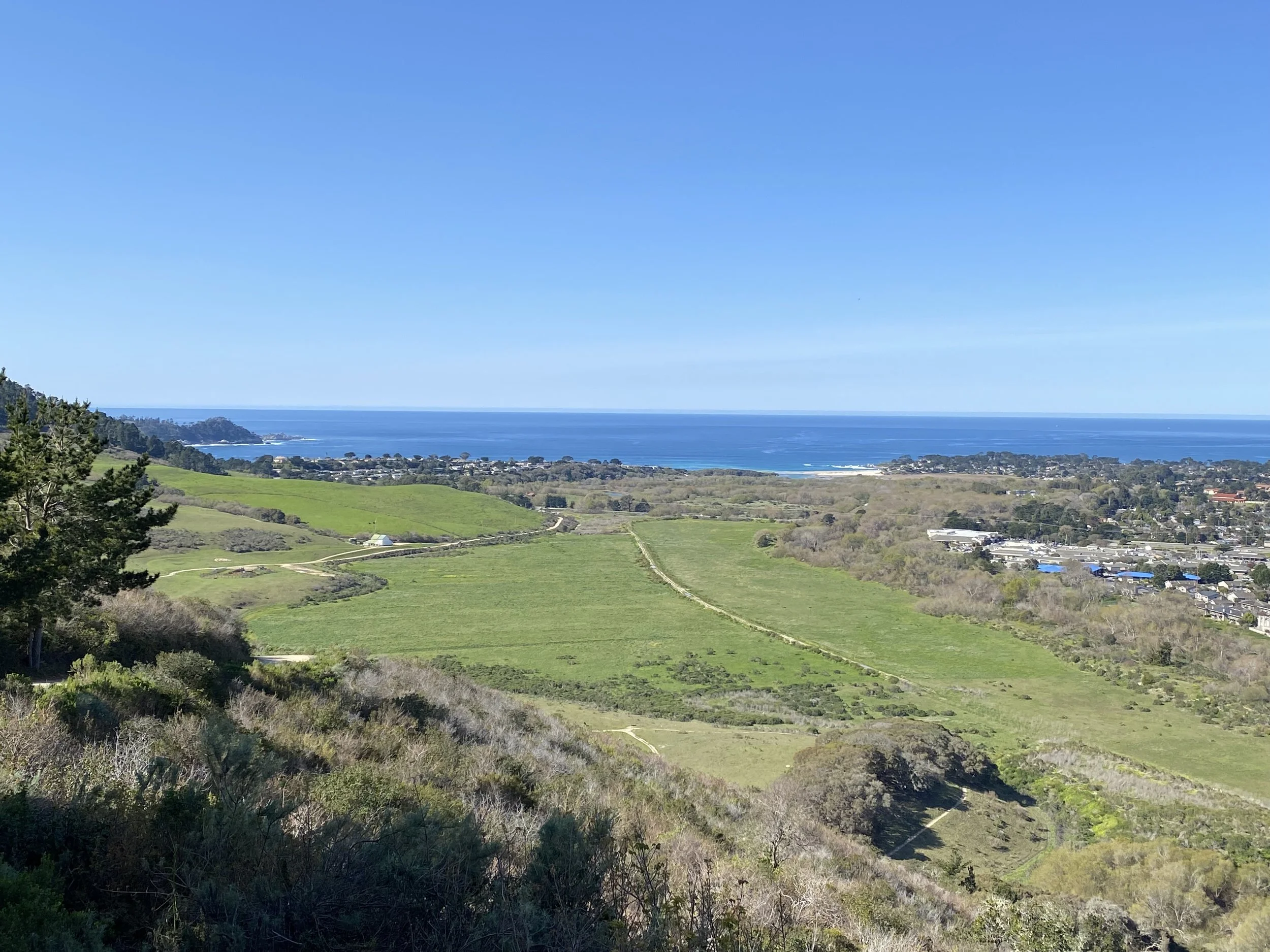
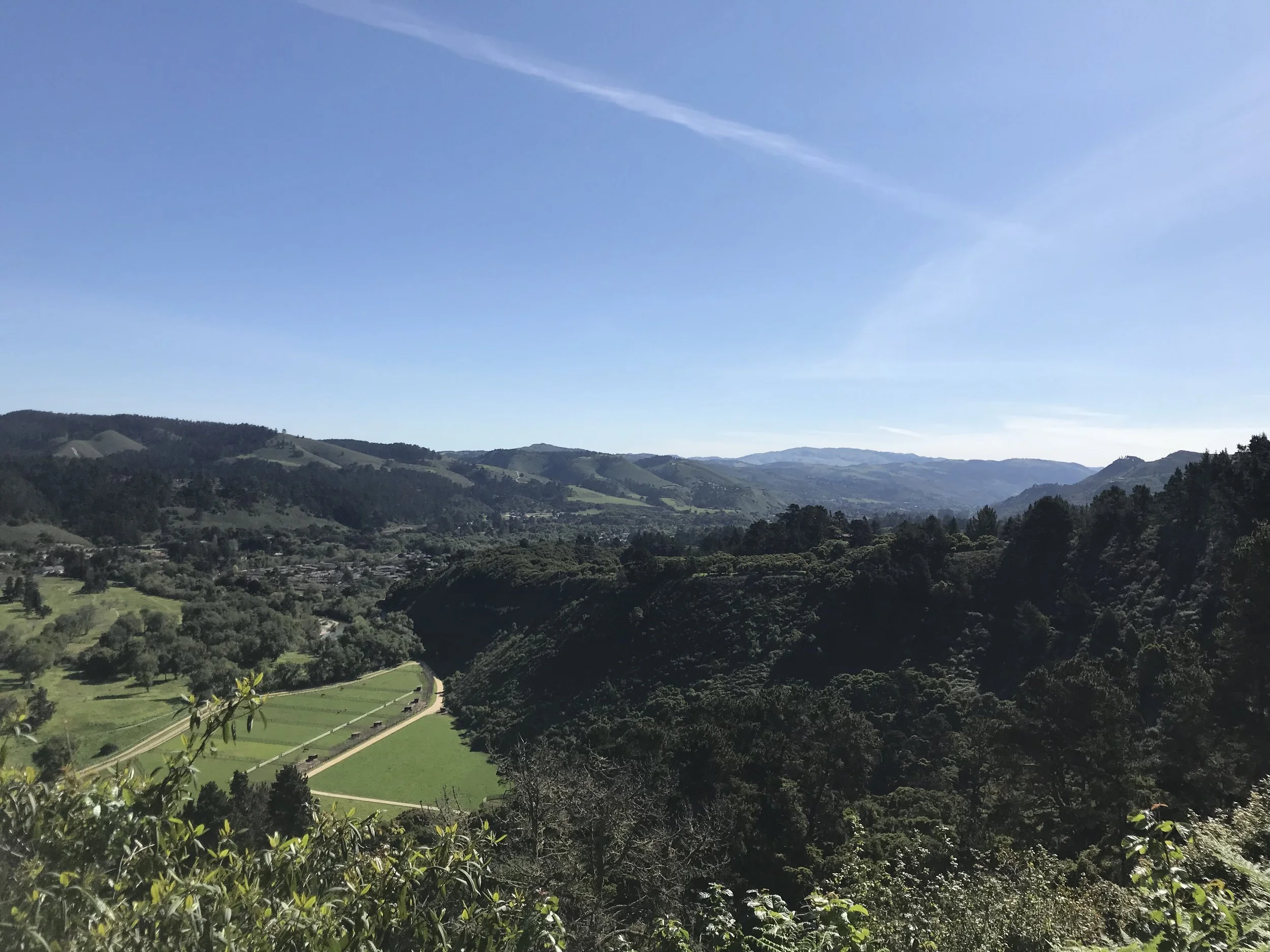
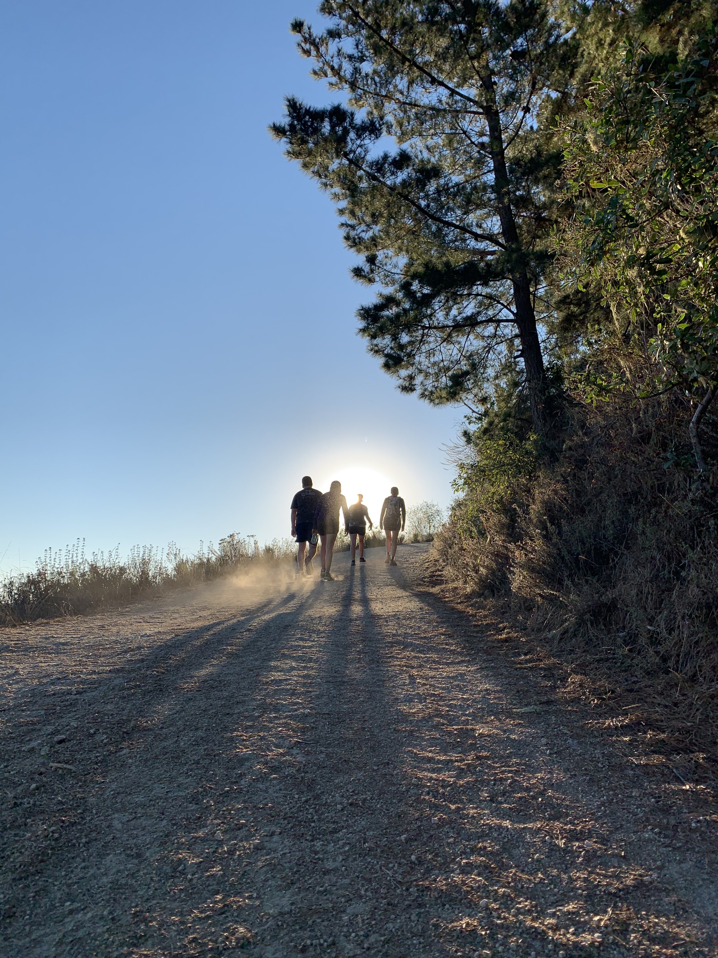
This is where the fun begins. Turn left, up the trail. You’ll notice right away the trail gets pretty steep and gains elevation quickly. Don’t forget to look up! The views of the pasture, coast and ocean come into sight. The elevation also raises your views over Carmel Rancho, Mission Fields and other landmarks at the Mouth of Carmel Valley. Soon you’ll turn the corner where views of Carmel Valley, Carmel Hill and Point Lobos come into sight. Continuing up the trail you’ll find a bench if you need a breather. Take in more views from this spot as you rest or sip some water. Dont feel bad if you see runners run past you up or down the mountain. This is a very popular trail for athletes of all types, including hikers like yourself. Keep heading up the trail and take in more views of Carmel Valley to the east.
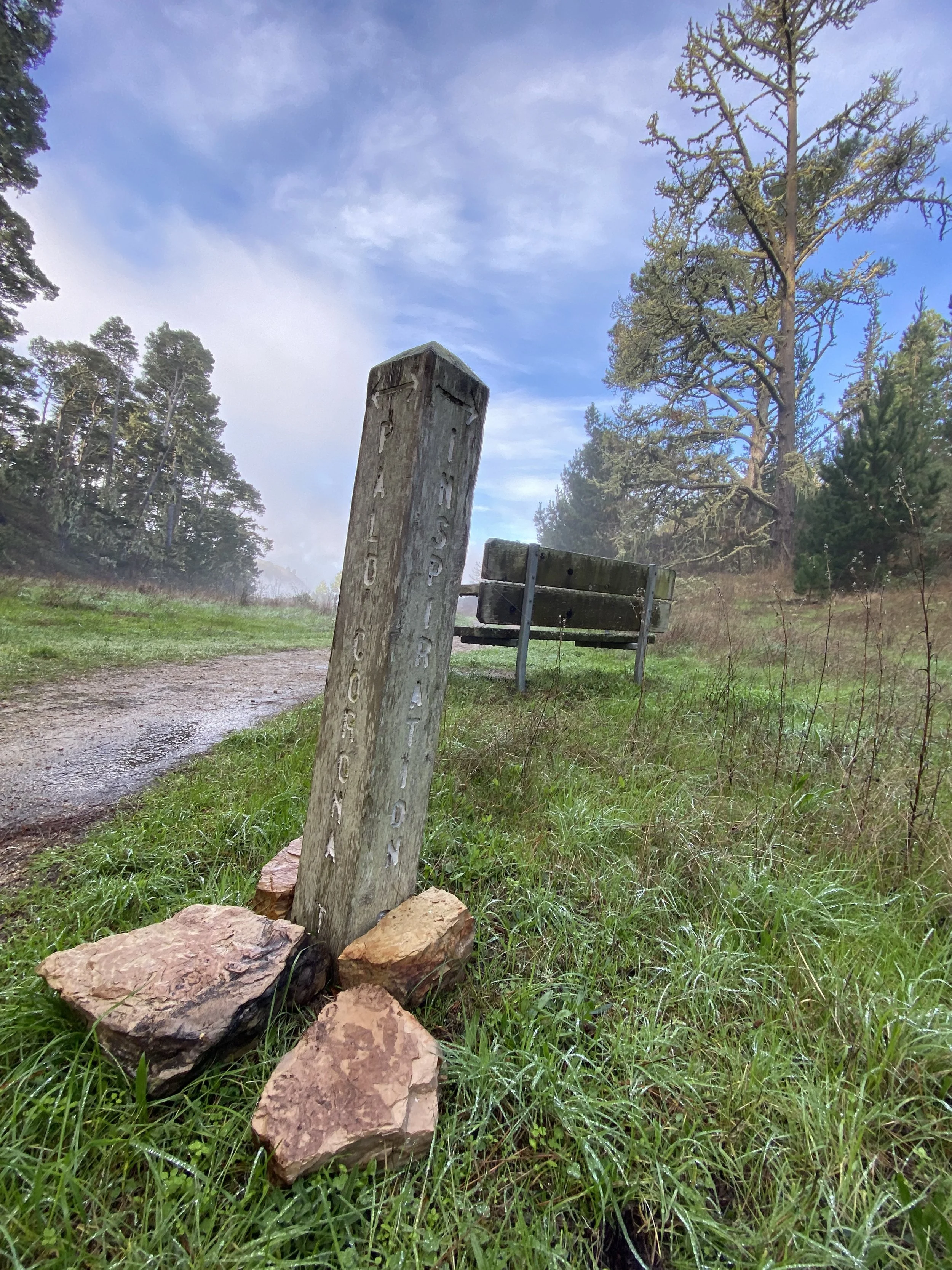
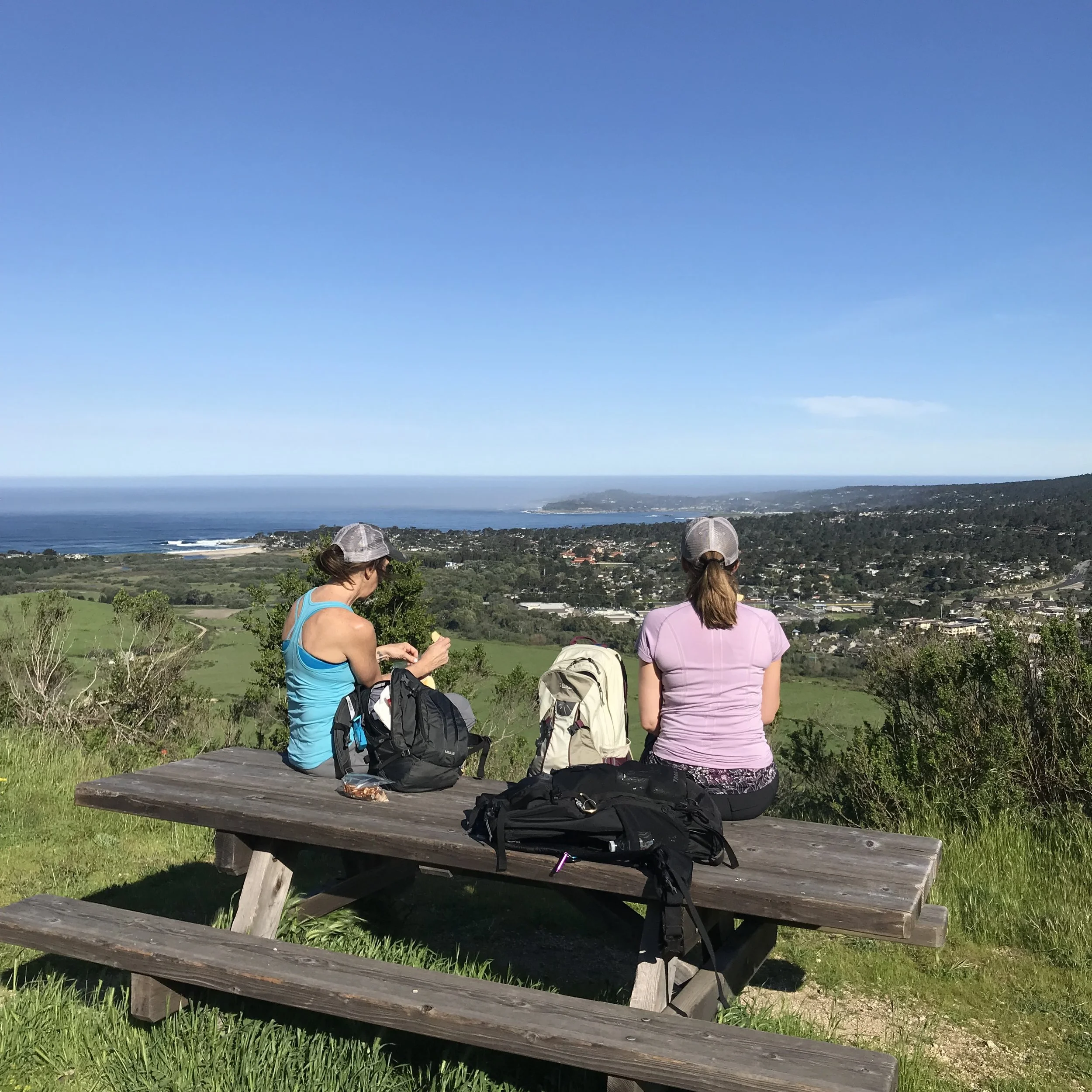
The climb stops at another cattle gate. You’ll notice a fork in the trail. Take it! Take the trail to the right. This winds around the hill on the coast side of the Palo Corona Road to Inspiration Point. Here you’ll find a couple benches and picnic tables. Stop and enjoy the views, once again, of the pasture, Carmel River Beach, Carmel Bay, Point Lobos, Stillwater Cove, Pebble Beach, Pescadero Point, Mission Fields, the Crossroads, Barnyard and the Highway 1 corridor.
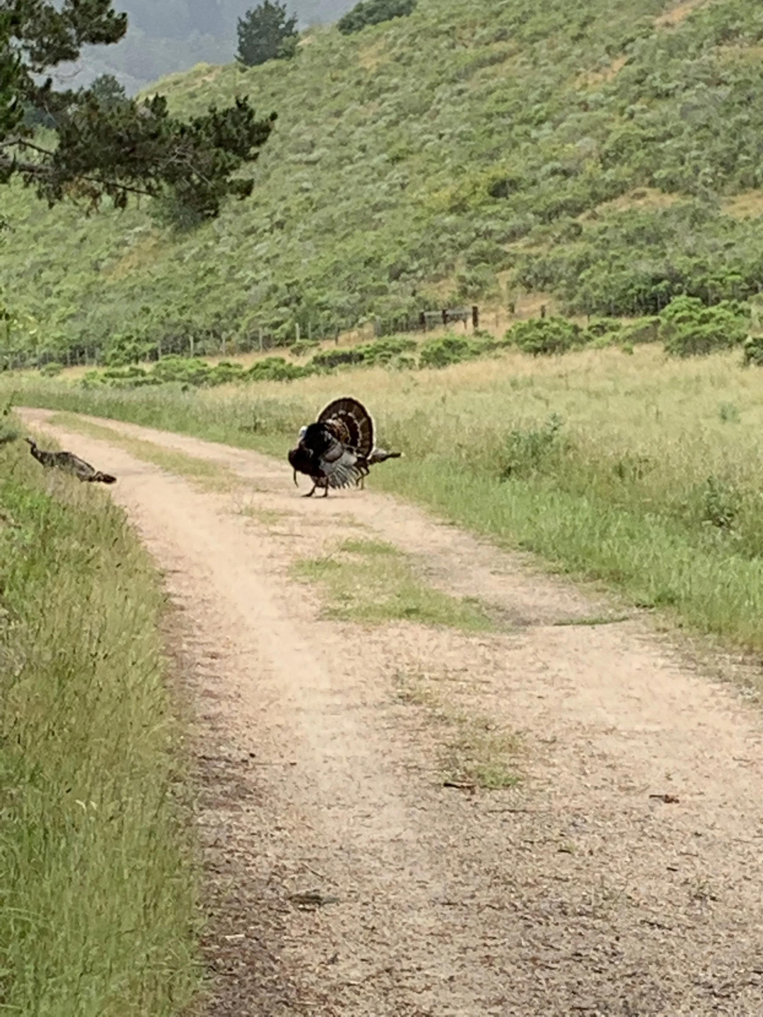
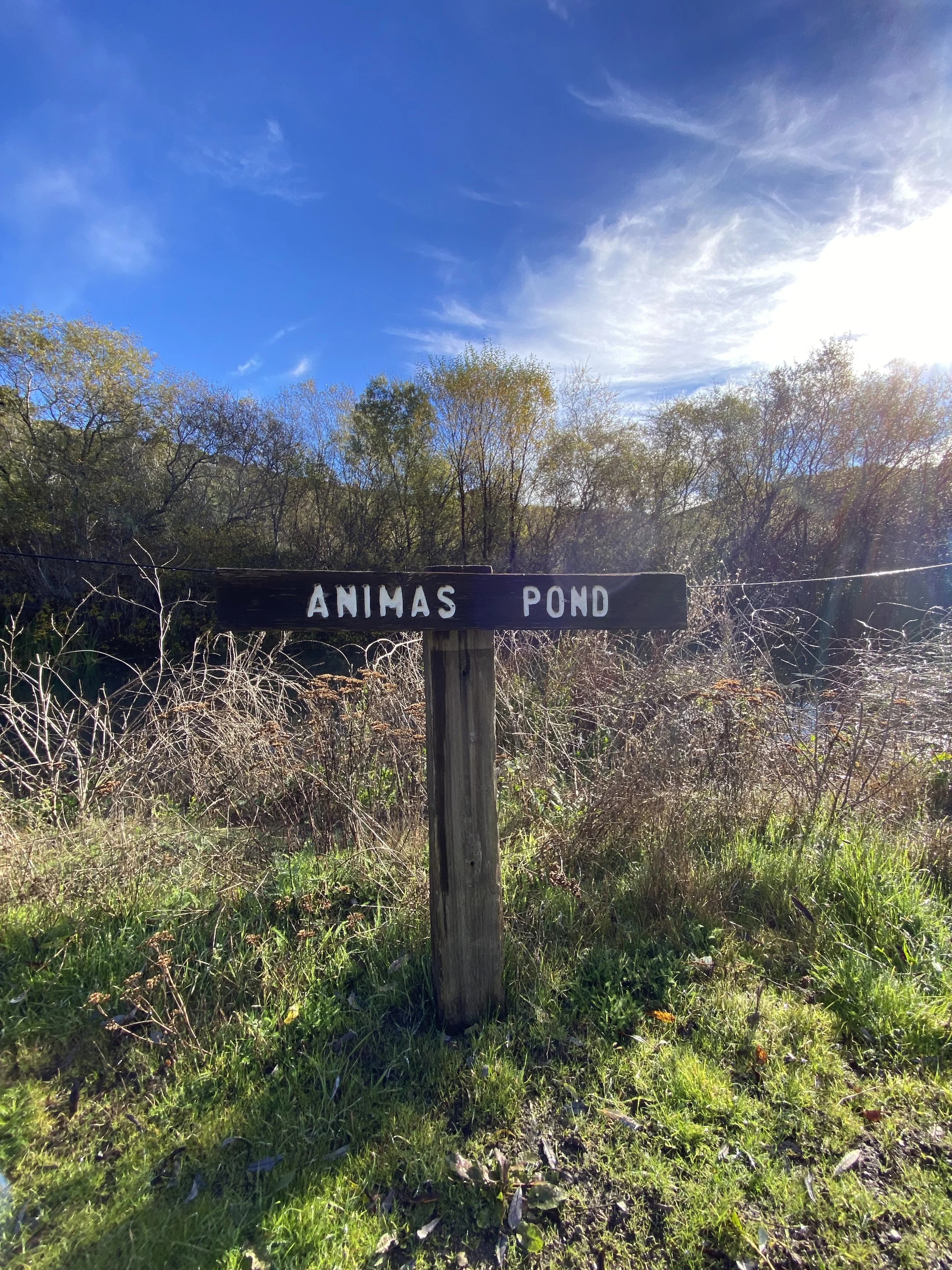
After a brief break to take in the sights, the trail wraps back around to the dirt road. Stay right. Follow the road to the Animas Pond. You’ll likely see wildflowers and possibly some wildlife along this section of the trail. The trail terminates the seasonal Animas Creek and the Animas “frog pond”, another good place for a break. If you have the proper permit you can continue past the cattle gate to San Jose Creek. Be aware, “they” are watching. If you’re not permitted to continue past the gate it’s best to turn back and head down.
Heading back to the start, take the Inspiration Point Trail to get another look at that view and take some pictures. As you head back down the mountain be sure to keep your eyes up as the views are incredible. If you head back to the parking lot and have some time stop in at the Discovery Center, visit the park ranger or docent and ask a few questions.
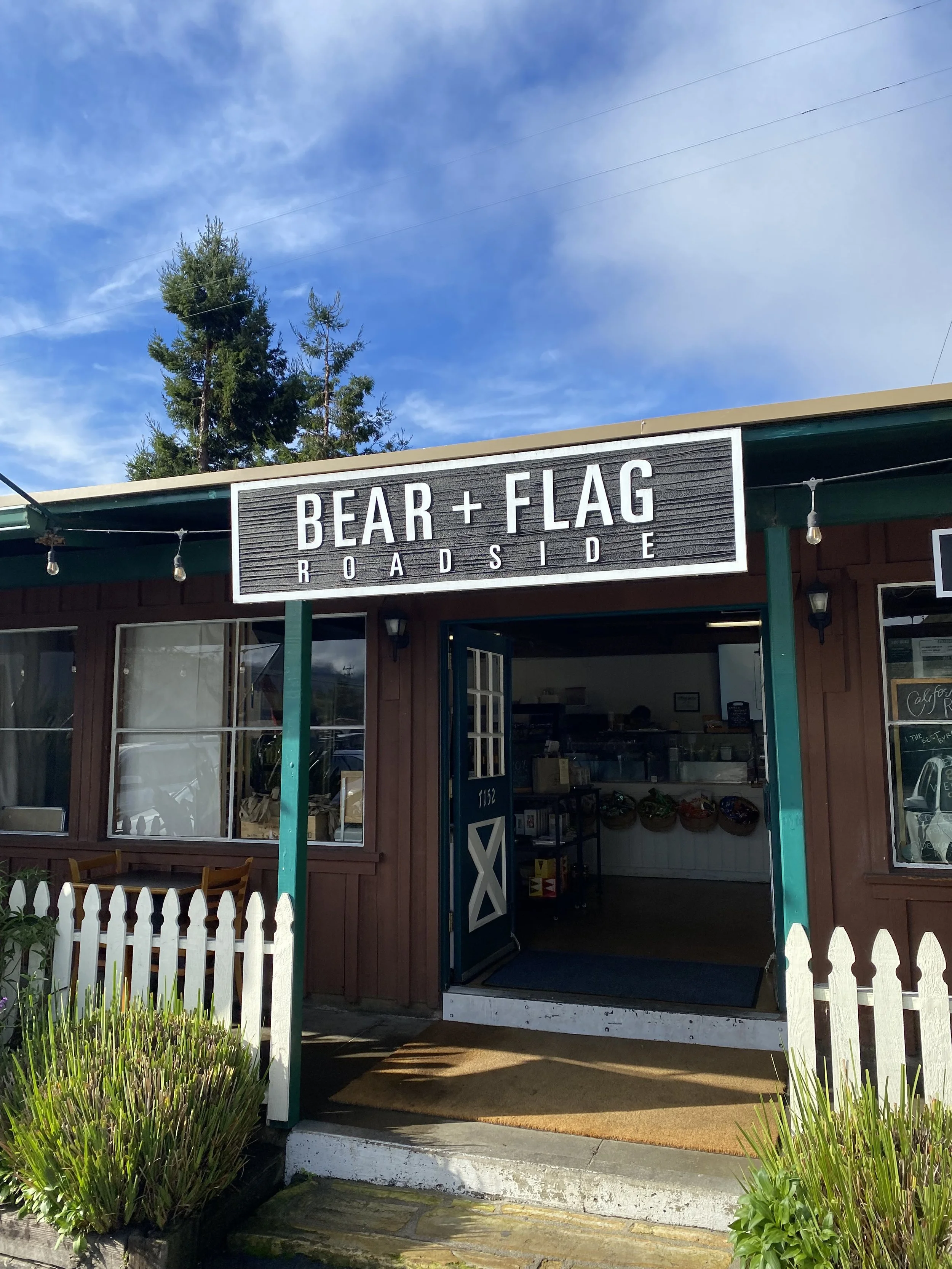
🍔🍺 you’re like us you’ve worked up a hunger and a thirst. There are many places to satisfy that need but our favorite is 2.5 miles into Carmel Valley. The Bear & Flag Roadside Eatery & Wine Shop is our favorite place to meet after our hikes in Carmel Valley. The Bear & Flag is a modern California Roadside Eatery & Wine Shop featuring a Chef Todd Fisher inspired experience with a wide selection of grab-n-go sandwiches, salads, BBQ, exceptional beer and wine selections, as well as coffee and ice cream. They have something for everyone, and it’s all GOOOOD! #yumyumgetchasome
There’s a few other places nearby that are great stops as well. Baja Cantina Grill and Filling Station offers a great atmosphere, great cantina food and wonderful drinks from their full bar. It’s a great place to get the party started. Earthbound Farms Farm Stand is also another gem in Carmel Valley. The Farm Stand is a favorite destination for organic food and gardens by locals and out-of-town visitors alike, the Farm Stand is a living celebration of Earthbound Farm’s mission to bring the benefits of organic to as many people as possible, in a most delicious and inspiring way.
Carmel Valley is also known as a renown wine region and offers many tasting rooms for visitors. It’s hard to miss a good wine selection in Carmel Valley. If wine is your thing, go check it out!
The next hike is one of the most beautiful spots in the Monterey/Carmel area. Follow the link below and you’ll get the “Dirt” on our next Trail.